
Chapman
on Distributed Volcanism and Distributed Volcanic Hazards
19-23 September 2022 in Flagstaff, Arizona
The registration deadline has passed.
About the Chapman
The purpose of this Chapman is to bring together scientists to discuss, develop, and test conceptual models of distributed volcanism. Focus by the scientific community is especially important now because of continuing growth of cities, communities, and critical infrastructure within sparsely monitored volcanic fields. The scientific program is now available.
Who should attend?
We invite participants from all disciplines to join us for three days of conference presentations and discussions at the USGS Astrogeology Science Center in Flagstaff, Arizona. We especially encourage participants from emergency management, geologic mapping, geochronology, physical volcanology, geomorphology, seismology, geodesy, geochemistry, exploration geophysics, hazards assessment, science communication, and related fields to attend.

Field trip
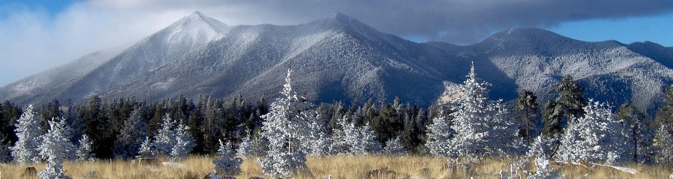
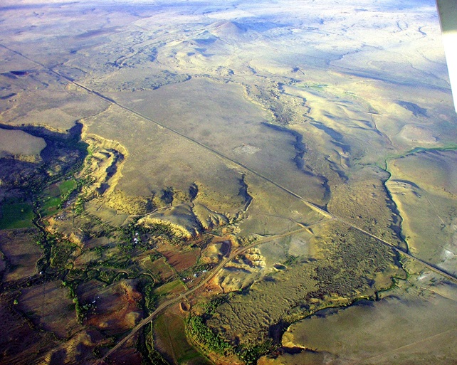
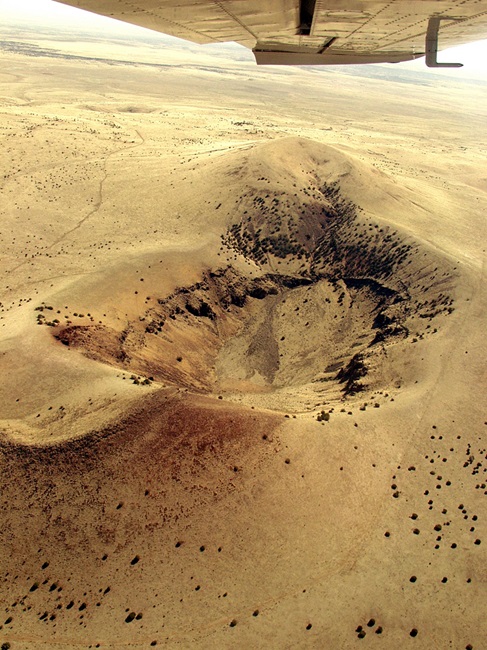
An optional two-day field trip (Thursday, 22 September and Friday, 23 September) to the Springerville Volcanic Field is being planned. Accommodations should not be reserved in Flagstaff for this portion of the meeting. We will travel to the 3000 km2, Plio-Pliestocene Springerville volcanic field, the southernmost of the Colorado Plateau-edge dispersive fields, in east-central Arizona (Condit, 1991, Condit et al., 1989b, 1999). We will examine key stratigraphic relations of the 501 units of the field, and discuss the magmatic mapping (Condit, 2007) techniques applied by the five mappers to unravel the eruptive timing and source location of the 451 vents, and to characterize the petrologic and geophysical properties of the lavas of the field (Condit et al., 1989a, Mnich and Condit, 2018). Weather and access permitting, we will visit one of the best exposed of the field’s five maar craters, look at an example of one of the four fissure vents and one of the field’s two shield volcanoes. We will also visit numerous neotectonic features, including faulted flows and post-flow reversal of flow topography features documented by Crumpler et al., 1989, 1994, examine outcrops supporting the volcanic hazard assessments of Mnich and Condit, 2018, several scoria cones, and also discuss the recurrence rate of volcanism in the field (Condit and Connor, 1996), and the control of tectonic inheritance on vent locations (Deng et al., 2017). Time, weather, and logistics permitting we’d like to visit Greens Peak, at 3080m elevation, the highest point in the field, from which many of the features can be viewed.
Download a large (319MB) geo-referenced Lithological Map of the Springerville Volcanic Field.
View this link to the cross-platform Dynamic Digital Map of the Springerville Volcanic Field, DDM-SVFv2, which is an online update of the Condit, 1991, 1995 and Condit et al., 1999 USGS MI Map 2431 maps.

References cited
- Condit, C.D., 1991, Lithologic map of the western part of the Springerville volcanic field, east-central Arizona (1:50,000): U.S. Geol. Survey MI Map I-1993, 2 sheets.
- Condit, C.D., 1995, Dynamic Digital Map: The Springerville Volcanic Field: Prototype color digital maps with ancillary data Boulder Colorado, Geol. Soc. Am. Digital Pub. Series DPSM01MC (CD-ROM for the Macintosh); v. 4.10.95 size: 36.7 megabytes.
- Condit, C.D., 2007, Magmatic Mapping: Distilling Liquid Moments In Time In Basaltic Volcanic Fields, Geol. Soc. Am. Abst. with Prog., v. 39, No. 6.
- Condit, C.D., 2019. Dynamic Digital Map of the Springerville Volcanic Field, DDM-SVFv2- 2018-09-10, an On-line Update of the Condit, 1991 and Condit et al., 1999 USGS MI Map 2431. (multi-platform downloads at URL: http://ddm.geo.umass.edu/DDM- SVFv2/ ).
- Condit, C.D., and Connor, C.B., 1996, Recurrence rates of volcanism in basaltic volcanic fields: An example for the Springerville volcanic field, Arizona: Geol. Soc. Am. Bull., v. 108, p. 1225-1241
- Condit, C.D., Crumpler, L.S., Aubele, J.C., 1989a. Field trip road log for the Springerville Vol- canic Field, southern margin of the Colorado Plateau. In: Chapin, C., Zidek, J. (Eds.), Field Excursions to Volcanic Terranes in the Western United States, Volume I: Southern Rocky Mountain Region, New Mex. Bur. Mines and Min. Res. Mem. 46, pp. 33–38.
- Condit, C., Crumpler, L., Aubele, J., Elston, W., 1989b. Patterns of volcanism along the southern margin of the Colorado Plateau: the Springerville field. J. Geophys. Res. 94 (B6), 7975–7986.
- Condit, C.D., Crumpler, L.S., Aubele, J.C., 1999. Lithologic, age-group, magnetopolarity and geochemical maps of the Springerville Volcanic Field, east-central Arizona, (1: 100,000). U.S. Geol. Survey MI Map I-2431 (5 sheets).
- Crumpler, L.S., and Aubele, J.C., and Condit, C.D., 1989, Influence Of Quatenary Tectonic Deformation On Volcanism In The Springerville Volcanic Field, Colorado Plateau, USA: New Mex. Bur. Mines and Min. Res. Bulletin 131, p. 64.
- Crumpler, L.S., and Aubele, J.C., and Condit, C.D.,1994, Volcanoes And Neotectonic Characteristics Of The Springerville Volcanic Field, Arizona, in R. M.
- Chamberlin, B. S. Kues, S. M. Cather, J. M. Barker and W. C. McIntosh, eds., Mogollon Slope: Socorro, New Mexico Geological Society Guidebook, p. 147-164.
- Deng, F., Connor, C.B., Malservisi, R., Connor, L.J., White, J.T., Germa, A. and Wetmore, P.H., 2017. A geophysical model for the origin of volcano vent clusters in a Colorado Plateau volcanic field. Journal of Geophysical Research: Solid Earth, 122(11), pp.8910-8924.
- Mnich, M.E., Condit, C.D., 2018, Basaltic magmatic mapping: A suggested methodology and the resulting petrologic and volcanic hazard implications from the Springerville volcanic field, east-central Arizona, J. Volcanol. Geotherm. Res. (2018), https://doi.org/10.1016/j.jvolgeores.2018.09.009
Scientific Program

Oral Presenter Guidelines
Please be sure you to bring a copy of your presentation on a USB drive as a backup. Presentations should be formatted to 16:9 if possible. 4:3 will also be supported. The podium laptop will be a PC.
-
Be considerate of other speakers and the audience by staying within your allotted time. The individual presentation time includes 3-5 minutes for discussion and changeover to the next speaker. Session chairs will hold you to the allotted time, which is essential to ensure adequate time for questions and discussion.
-
Please discuss the material as reported in your submitted and approved abstract.
-
Prepare your presentation in advance so that your ideas are logically organized, and your points are clear.
-
Take time to rehearse your presentation. If your presentation runs longer than the allotted time, eliminate the least essential material and rehearse again.
-
Give an opening statement to acquaint the audience with the nature and purpose of the study. Speak slowly and clearly. Word choice should be simple: use active words and short sentences.

Poster presenter guidelines
Each presenter will have a poster space of that is 4 feet high by 8 feet wide (1.2 meters high by 2.4 meters wide). Presenters should refer to the scientific program for information on when to display their poster. The scientific program is available here.
The presentation must cover the material as cited in the abstract. All poster presenters will also provide a short 45 second overview of their poster to the entire group the day of their presentation. Please prepare one slide, that is not a PDF of your poster, to accompany your poster introduction.
-
Place the title of your paper and your paper number prominently at the top of the poster board to allow viewers to identify your paper. Indicate 1) the abstract’s presentation number, 2) title, and 3) authors’ names.
-
Highlight the authors’ names, e-mails, and address information in case the viewer is interested in contacting you for more information.
-
Prepare all diagrams or charts neatly and legibly beforehand in a size sufficient to be read at a distance of 2 meters. Paragraph and figure caption text should be AT LEAST 24-point font (0.9 cm height) and headers AT LEAST 36 point font (1.2 cm height). Use creativity by using different font sizes and styles, perhaps even color.
-
Use different colors and textures/symbols for each line or bar contained in your graph or chart. A serif font (e.g., Times) is often easier for reading main text, and a non-serif font (e.g., Arial or Helvetica) for headers and figure labels.
-
Organize the paper on the poster board so it is clear, orderly, and self-explanatory. You have complete freedom in displaying your information in figures, tables, text, photographs, etc.
-
Use squares, rectangles, circles, etc., to group similar ideas. Avoid cluttering your poster with too much text. Label different elements as I, II, III; or 1, 2, 3; or A, B, C, making it easier for a viewer to follow your display.
-
Include the background of your research followed by results and conclusions. A successful poster presentation depends on how well you convey information to an interested audience

Format and schedule
-
1The theme of the first day is geology and petrology with an additional focus on the broad concepts surrounding distributed volcanism. There will be oral presentations and allotted time for discussion followed by a poster session.
-
2The second day’s theme is geophysics and monitoring efforts at distributed fields with some talks focusing in on specific in-depth case studies. Oral presentations and discussion will be followed by discipline-specific break-out groups and a poster session.
-
3On the third day oral presentations will focus on volcano hazards, community response and planning. Break out groups will reconvene to distill important points from the prior 3 days, which will lead into a discussion amongst all attendees.
-
4Days 4 and 5 are scheduled for the optional field trip to the Springerville volcanic field.

Abstract submission policies
Abstract submissions reopened in April 2022 for new submissions and changes to existing submissions. The abstract submission period closed on 28 June 2022. You are not required to be an AGU member to submit an abstract. There is no fee for submissions.
Abstracts must focus on scientific results or their application. The Program Committee may decline abstracts with other focuses.
By submitting an abstract, you are obligated to give a presentation in the designated manner assigned by the Program Committee. Your submission also grants AGU permission to publish the abstract.
You cannot request oral presentations, although you may request a poster presentation.

Abstract submission guidelines
-
1Your abstract title should be no more than 300 characters and the abstract text must be less than 2000 characters. The character limit includes punctuation, but not spacing.
-
2In lieu of adding the names of individual team members, you may reference a research team in the ‘Title of Team’ field during the submission process.
-
3You may add one table or image to your submission. If you would like to include multiple images, you must combine the images and save them as one file. We prefer image files be .jpg, however, .png, and .gif are also supported file types.
-
4Submissions can be submitted and edited at any time up until the abstract submission deadline.

IMPORTANT LOGISTICS FOR THE DISTRIBUTED VOLCANISM FIELD TRIP, 22-23 SEPTEMBER 2022
Much more information about the geology of the Springerville volcanic field and about our road stops will be provided on the field trip. In advance of this, please be aware of this important logistical information concerning the post-meeting field trip.
The field trip is currently at capacity. If you are interested in attending the post-conference field trip please contact Wendy Stovall.
Only conference participants who register for the field trip will be allowed to participate. The maximum field trip participation is 50 people. We are currently at capacity but please contact Wendy Stovall to be placed on a wait list. If you can no longer participate in the field trip, contact AGU immediately to remove yourself from the list.
We anticipate that the expenses for the field trip will be:
- Lodging (shared room): $55
- Lunch (two days): $30
- Snacks and water: $10
- Gas and related charges: $15
- Total $110 USD
This does not cover your cost for dinner in Springerville on 22 September, breakfast in Springerville on 23 September, and other incidental expenses you might have. Any hotel costs for Friday, 23 September are not included either.
When you receive confirmation of field trip participation, please contact Reeds Lodge in Springerville to put one of the blocked rooms into your name as soon as possible. They can be reached at [email protected] or (923) 333-4324. Request a room in the "Chapman Conference" block. The field trip is being run at cost, and the organizers will collect money for group expenses in September. In late August, field trip organizers will request additional information related to transportation, health and safety, and dietary accommodations. If you have questions about the field trip please email Wendy Stovall.
General Schedule (field trip dates: 22-23 September 2022)
Day 1 – leave Flagstaff and tour the southern Springerville volcanic field
We plan to leave the Astrogeology Building parking lot (location of the conference) at 8:00 AM. It is about a 2 hour and 30 minute drive from Flagstaff to our first outcrop, near the town of Show Low (AZ).
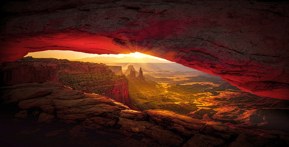
Subsequent stops will take in various lava flow, scoria cone and related features as we work our way around the southern part of the volcanic field. Weather permitting, we should have spectacular views of the volcanic field and of the Mogollon Rim, the dramatic southern edge of the Colorado plateau.
Lunch will be provided on Day 1 as part of the field trip. Be sure to let us know your dietary restrictions and/or preferences when you register for the field trip. Water will be provided but please bring your own water bottle!
On the evening of Day 1 we will arrive in Springerville (AZ) and stay at Reed’s Motel. We will be on our own for dinner – but likely we will all be at the same restaurant since options are limited!
Day 2 – leave Springerville and return to Flagstaff, Phoenix, or Springerville
We will leave the motel parking lot for the field promptly at 8:30 (breakfast is available across the street from the motel for those who want to grab breakfast beforehand). We will drive out of Springerville around the northern side of the volcanic field, stopping to investigate spectacular scoria cone alignments, vent structures, and domes.
Lunch will be provided on Day 2 as part of the field trip. Water will be provided but please bring your own water bottle!
Our last stop of the day will be east of Show Low. We ask field trip participants to specify when they register if they are returning to Springerville (those leaving for Albuquerque the next day), returning to Flagstaff, or going on to Phoenix. We will make every attempt to accommodate these options at the end of the trip.
Weather and clothing
Usually, Springerville (AZ) experiences high temperatures of 68-77 F (20- 25 C) and lows of 39-47 F (4-8 C) in September. But, please be prepared for the unexpected as elevations are around 6000 ft (1800 m) and the weather is capable of extremes. Please bring cool weather gear (hat, gloves, wind gear) and rain gear just in case. A sun hat, sun glasses, lip balm and sun screen are essential. We recommend field boots.

Safety and Cultural Awareness
This field trip requires moderate walking away from the vehicles, including walking on lava flows and related rugged terrain for short distances. The elevation of the Springville volcanic field is around 1800 m (6000 ft) and it is not unusual for hikers to experience shortness of breath. Please be aware of your own limitations. If you have a medical condition, please consider if this might affect your participation when you register.
We will take precautions to ensure a safe field trip. Please be aware that some field trip stops are near two-lane highways. We ask all field trip participants to be aware of their surroundings and especially to be careful to avoid traffic on roadways.
We will not be able to transport alcohol in field-trip vehicles and consumption of alcohol in these vehicles or while we are in the field is expressly forbidden. Smoking is not allowed on the field trip.
Parts of the trip cross White Mountain Apache lands, Arizona Trust lands, and BLM land. Please treat the environment and those you encounter in it with respect.
Need more info?

Registration rates and policies
The registration fee includes access to the scientific program, refreshment breaks and lunch on the three days of the conference.
Fees
- Professionals: $550.00 USD
- Students: $425.00 USD
- Low-income and lower-middle income* country residents: $425.00 USD
*Low-income and lower-middle income countries as defined by the World Bank.
Cancellation policy: If you must cancel your registration, you must email AGU with written notification.

Housing
Accommodations should be booked in Flagstaff for the first three days. If you plan to attend the field trip, accommodations will be located in closer proximity to the Springerville Volcanic Field.

Conference Location
The conference will be held at the High Country Conference Center https://highcountryconferencecenter.com; in Flagstaff. HCCC is located at 201 West Butler Avenue. The conference is on the first floor of the main building in Humphreys.

Flagstaff Facts
- Temperatures in September range from 74 to 42 degrees Fahrenheit. Pack layers! Flagstaff is at an elevation of 7,000 feet so drink lots of water and don’t forget sunscreen.
- Flagstaff airport is approximately 15 minutes from downtown Flagstaff. Phoenix airport is approximately 2 hours away. Amtrak offers twice daily service into Flagstaff on the Southwest Chief line.

Current as of 15 September 2022
AGU is committed to the health and well-being of our meeting attendees, staff and meeting partners. As part of our effort to hold a safe and productive meeting, it is expected that all attendees, including all AGU staff, are fully vaccinated if they are attending the Chapman Conference on Distributed Volcanism and Volcanic Hazards in Flagstaff, AZ.
The Distributed Volcanism Chapman strives to provide a safe health environment for all attendees. Thank you for following our safety protocols onsite regarding masking (masking unless you are eating or drinking or presenting) and antigen testing (antigen tests available for attendees).
If you are not feeling well and are an onsite attendee, please stay at your hotel and take a rapid antigen test to see if you are positive for COVID-19. If you begin to feel unwell onsite, please approach an AGU staffer to test for COVID immediately. If you do test positive for COVID-19 while onsite, please fill out our health reporting form and reach out to meeting director Victoria Forlini. We will contact you to see what assistance we can provide.
The meeting organizers have chosen to have the meeting be fully masked. You can see more resources on COVID-19 from the CDC regarding spread, quarantine, and other items.
During the Event
Mask Requirements
Masks are required in the Chapman Conference meeting space at all times unless you are actively eating or drinking. The only exception is that speakers who speak from the podium in the meeting room, if they so choose, may take off their masks while talking.
AGU will provide masks for those who forget to bring one on-site.
Testing
Onsite rapid antigen tests will be available for attendees. A list of locations in Flagstaff that offer testing is available on the Coconino County website.
Childcare
Onsite childcare will not be provided at the conference. Children, including vaccinated children, will not be allowed to attend.
State And Local Guidelines
Attendees are expected to adhere to local and state safety protocols.
Links to additional travel and safety resources:
What to do if you are feeling sick
If you are not feeling well, or develop any symptoms associated with COVID, please remain in your hotel room. Please contact Lauren Parr, Senior Vice President of Meetings and Learning at [email protected] so that we can assist you. If it is an emergency, please seek medical attention immediately.
If you have tested positive for COVID while onsite at the meeting, please complete this form to report.
After the event
Continue to monitor your health for symptoms of COVID-19 for up to 14 days after your departure from the conference. Read the CDC quarantine guidelines if you have been exposed to COVID-19.
Chapman Program Committee
|
|
Institution | Location |
| Chuck Connor | University of South Florida | United States |
| Wendy K. Stovall | Yellowstone Volcano Observatory, USGS | United States |
| Michael Ort | Northern Arizona University | United States |
| Michael Poland | Yellowstone Volcano Observatory, USGS | United States |
| Elise Rumpf | Astrogeology Science Center, USGS | United States |
| Greg Vaughan | Astrogeology Science Center, USGS | United States |