Citation
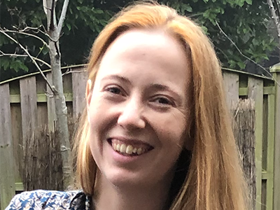
Dr. Susanna Ebmeier is an exceptionally talented geophysicist, at the forefront of exploiting the revolution in satellite geodesy to advance our understanding of volcanic processes. She has a passion for using satellite observations to improve society’s response to volcanic hazards; her research has had a significant impact on scientific understanding and crisis management.
Dr. Ebmeier’s primary geodetic tool is satellite radar interferometry (interferometric synthetic aperture radar, or InSAR). She has conducted groundbreaking research and developed innovative techniques that have probed the complex interactions between tectonics and volcanism and has pioneered the development and exploitation of global geodetic data sets to improve our understanding of magmatic processes.
Creativity has been a hallmark of Dr. Ebmeier’s career. Early on she developed a new method capable of simultaneously determining the thickness/volume of volcanic deposits, alongside extrusion rates, and rates of lava subsidence. More recently she has focused on exploiting advances in signal processing methods, such as independent component analysis, for the extraction/analysis of volcanic signals.
Dr. Ebmeier has consistently recognized the importance of working closely with scientists in volcano observatories. In Ecuador, her collaborations with the Instituto Geofísico (IG) have had a direct impact on society. During the 2014 seismic crisis at Chiles–Cerro Negro, IG increased the alert level to Orange (Level 3 of four levels) and evacuated approximately 3,500 families. Dr. Ebmeier responded rapidly to a request for assistance, using InSAR to identify the tectonic mechanism behind the earthquakes, a result critical to IG’s decision to lower the alert level, allowing evacuees to return home. Recently, Dr. Ebmeier led the development of COMET’s (Centre for Observation and Modelling of Earthquakes, Volcanoes and Tectonics) Volcano Deformation Portal, which provides near-real-time deformation monitoring data globally; she has supported scientists at observatories, as well as collaborators/stakeholders, to use this vital global resource.
Dr. Ebmeier is increasingly involved in international efforts coordinating satellite observations at volcanoes, serving as cochair of the Committee on Earth Observation Satellites Volcano Demonstrator, where she has facilitated rapid no-cost access to expensive and/or inaccessible satellite data, including from commercial operators. She has further worked on ensuring that end users have the data products they need to support event response during crises—vital and unselfish service that benefits both science and society.
Dr. Ebmeier is a young leader in the field of satellite geodesy, particularly applied to volcanic hazards assessment and mitigation. She is setting the agenda in the use of satellite geodesy in volcano observatories while remaining focused on solving fundamental scientific problems and developing new methods and interpretive tools.
—Tim Wright, COMET, University of Leeds, Leeds, U.K.; Juliet Biggs, COMET, University of Bristol, Bristol, U.K.; and Mike Poland, Yellowstone Volcano Observatory, U.S. Geological Survey, Vancouver, Wash.
Response
I thank my nominators for their kind citation and for their thoughtfulness in putting me forward for the John Wahr Early Career Award. I feel honored to have been recognized by the AGU geodesy community, which has had a big influence on my science and academic outlook.
I am very grateful for having been introduced to supportive members of the international volcano geodesy community early in my Ph.D. research. Since then, I have benefited greatly from their encouragement, advice, and example as research leaders. I was especially fortunate as a postdoctoral researcher in being supported to build connections with other researchers internationally, both at universities and in volcano observatories. This has shaped the path of my own research over the past decade, broadening my scientific interests and helping me keep a focus on the application of fundamental science to real-world problems.
A great privilege of being a researcher is being able to keep learning and trying new things. I have recently had the pleasure of working with many postgraduate students and sharing in their exploration of new ideas. I would like to thank them, as well as my previous supervisors, current colleagues, and collaborators. I value all of our shared efforts, struggles, and inspiration. Finally, thank you to John Elliott for his insightful honesty, humor, and support in all aspects of life.
—Susanna K. Ebmeier, University of Leeds, Leeds, U.K.
Field Photos
Citation
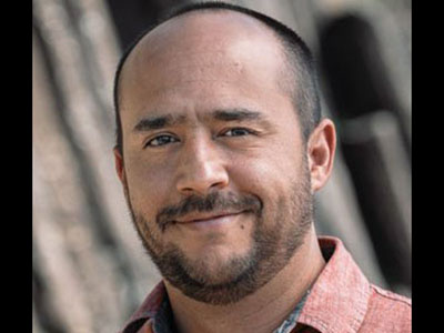
It is a great pleasure and honor to write this citation for Diego Melgar, winner of the 2022 John Wahr Early Career Award. Diego Melgar is a prolific early-career scientist whose research is notably deep and broad, pushing the interdisciplinary boundaries between geodesy and seismology. Indeed, he is a pioneer of the nascent field of seismogeodesy. His research is transformative, with broad impact by introducing real-time geodesy and rapid modeling of seismogeodetic data to the operational world of earthquake and tsunami warning.
Diego is both an accomplished geodesist and seismologist, with a focus on large earthquakes and how they develop in time, and tsunami modeling for early warning. His publication record is simply stellar for someone at such an early-career stage. With only 8 years since his Ph.D. in 2014, Diego has an astounding record of over 80 peer-reviewed journal publications, many of which have been cited over 100 times, with a total of over 3,700 citations. His body of papers demonstrates consistent innovation, following a coherent theme of attempting to understand the rupture process for large earthquakes.
In addition to scientific impact, his research is having a profound impact on meeting societal needs, as his applied research relates to tsunami warning systems. Diego has taken this avenue of applied research to a much higher level where the research is transformative; that is, it is now at the application stage. Diego’s contributions are significant, with a focus on improving the modeling of tsunami genesis.
I would also like to highlight Diego’s extensive mentoring of students and postdocs and his service to the scientific community. Notably, he was selected to serve on the National Academy of Sciences (NAS) Committee on Solid Earth Geophysics. Importantly, NAS committees have a significant impact on the future of the field. Also notably, Diego serves on the NOAA Tsunami Science Technical Advisory Panel, which helps his science become transformative and practical for society. In addition, he has served on numerous committees for important scientific consortia such as UNAVCO (geodesy), Incorporated Research Institutions for Seismology (seismology), and the International Association of Geodesy Global Geodetic Observing System.
In conclusion, Diego Melgar is leading the way on better models for earthquakes and tsunamis that can be applied to early warning and have societal impact. He has a stellar record for someone at such an early-career stage and is a strong role model for students and other early-career scientists.
—Geoffrey Blewitt, University of Nevada, Reno
Response
It has been a great pleasure to be part of a thriving geodetic community during a time of significant technological and scientific innovation. The proliferation of real-time networks, advances in data science, and the occurrence of numerous catastrophic earthquakes have made the past decade a moment of great historical relevance for research into large earthquakes and their physics and hazards, and for real-time response systems.
First and foremost, I am grateful to my partner and fellow geophysicist Valerie Sahakian for her companionship and for endless discussions about the mysteries of life, our planet and its people, and the universe at large. I am indebted to all my teachers and mentors who have selflessly given their time to my training and education: Xyoli Perez-Campos, who imbued in me a love of Earth science, Yehuda Bock and the group at the Scripps Orbit and Permanent Array Center (SOPAC) for teaching me about real-time Global Navigation Satellite Systems (GNSS), and Richard Allen and the Berkeley Seismology Lab where I learned all about early warning systems.
I am especially grateful to my colleagues, the postdocs, the graduate students, and the community at the University of Oregon where I have found a wonderful place to thrive as a scientist, one that values the human aspects of the scientific endeavor as much as the technical ones.
My love for Earth science exists because our planet is still a source of awe and of myriad open questions. Deepening our understanding of them can bring one great intellectual joy, but it also allows us to harness the new knowledge for the social good. Combining those two facets of science has always been my fundamental motivation.
While Earth science has a long road ahead to fulfill its promise of becoming just and equitable, I am heartened that we live in a time of vigorous debate surrounding the nature of our shared societal values as a scientific community of practice. Our fields and research are meaningless without people. Science ought to be an endeavor shared by a diverse community of individuals all problem-solving, from distinct perspectives, together for a bright future. Here, geodesy has a fundamental role to play, and so I am honored to receive the John Wahr Early Career Award. It strengthens and motivates me to keep pushing forward.
—Diego Melgar Moctezuma, University of Oregon, Eugene
Field Photos
Service and Leadership
Citation
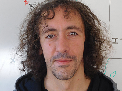
It is with great pleasure and honor that I write this citation for Paul Rebischung, winner of the 2022 Ivan I. Mueller Award for Distinguished Service and Leadership. Paul deserves such recognition by the AGU Geodesy section for his constant dedication to serving and leading the international geodetic community in producing terrestrial reference frames, a critical foundation for the application of geodesy to Earth sciences. Indeed, such dedication has affected and facilitated geodetic research all around the globe, in ways that perhaps users of Global Navigation Satellite Systems (GNSS) data may not fully appreciate. As a Ph.D. student, Paul began his career of service as a member of the International GNSS Service (IGS) Reference Frame Working Group. His initial contribution was to evaluate how GNSS might improve the International Terrestrial Reference Frame (ITRF). Implementing Paul’s research has had a huge impact on improving products of IGS and the International Earth Rotation and Reference Systems Service (IERS). Specifically, Paul developed and implemented the methodology that IGS uses to produce terrestrial reference frame solutions that are aligned to the ITRF by rigorously combining solutions from IGS Analysis Centers. He was also responsible for the IGS input to ITRF2014 and now ITRF2020. In 2017, Paul was appointed chair of the IGS Reference Frame Working Group and took a seat on the IGS Governing Board. Every geodesist, including myself, who is in the business of generating highly precise GNSS position time series uses these reference frame realizations. As such, Paul’s service has played a role in every journal article over the past decade that has used high-precision GNSS position time series, for a wide variety of Earth science applications. In addition to chairing the IGS Reference Frame Working Group, he has served on IERS Working Groups that have further developed IAG products, and on several IAG Working Groups including (1) Global Combined GNSS Velocity Field, (2) Toward Reconciling Geocenter Motion Estimates, (3) Constraining Vertical Land Motion of Tide Gauges, and (4) Integration of Dense Velocity Fields into the ITRF. As current chair of the IGS Reference Frame Working Group, Paul takes a leadership role in the IGS reprocessing of GNSS data, which leads to more accurate reference frames and GNSS orbits and clocks used by geodesists. His service is a critical component for future generations of ITRF and for the continued improvement of products upon which the geodetic community depends.
—Geoffrey Blewitt, University of Nevada, Reno
Response
I am extremely honored to receive this award and would like to thank everyone involved in this nomination. Receiving an award bearing the name of Ivan I. Mueller, one of the founders of the International GNSS Service (IGS), in which I have been involved for the past 13 years, is especially meaningful to me.
I would like to address deep thanks to Zuheir Altamimi, without whom I would not have been introduced into the IGS community, nor might I have ever started a scientific career. Sincere thanks also to Jim Ray, who acted as my mentor during my early years in the IGS. Thanks as well to the numerous colleagues with whom I have worked and learned over the years, both at my home institute, Institut National de l’Information Géographique et Forestière (and now also Institut de Physique du Globe de Paris), and in the framework of the IGS.
The IGS community forms a highly stimulating scientific environment, as well as a remarkable example of global cooperation, successful in providing high-quality, open-access GNSS data and products useful for a wide range of applications. It has been a chance and an honor to participate, at my humble level, in the IGS adventure. In the coming years I hope I can continue to serve the geodetic community by supporting further advancements of IGS products, as well as of the International Terrestrial Reference Frame (ITRF), the necessary backbone for global monitoring of Earth and for global precise positioning. Geodesy has reached unprecedented accuracy, but the requirements have meanwhile never been so stringent. There are still many challenges ahead and prospects for motivating research!
—Paul Rebischung, Institut National de l’Information Géographique et Forestière, Institut de Physique du Globe de Paris, Paris
Field Photos
Service and Leadership
Citation
Harald Schuh is an internationally recognized leader in the field of very long baseline interferometry (VLBI). He played a pioneering role in promoting this technology to support the establishment of the International Terrestrial Reference Frame (ITRF) and the realization of the International Celestial Reference System (ICRS). Together with international colleagues, he founded the International VLBI Service (IVS), a collaboration of organizations that operate and support global VLBI components, and he served as the chair of this organization from 2007 to 2013. Harald Schuh’s dedication to IVS and his great vision led to the development of the VLBI Global Observing System (VGOS) with a number of new radio telescopes in the United States, Japan, Germany, Spain, Norway, Sweden, Finland, and China.
Harald Schuh’s passionate pursuit of frontier research in geodesy and his unselfish contribution and services to various scientific communities are impressive. He has been a member of several important national and international organizations, including chair of the Scientific Advisory Board of the German Geodetic Research Institute (DGFI) in Munich, a member of the Scientific Advisory Board of the European Optical Fibre Project NEAT-FT, a member of the Evaluation Board of the German Research Group on Satellite Geodesy (FGS), vice president of the Austrian Society for Surveying and Geoinformation (OVG), president of the Austrian Geodetic Commission (ÖGK) and of the Austrian National Committee of the International Union of Geodesy and Geophysics (IUGG), president of IAU Commission 19 on Earth Rotation, elected member of the IAG Executive Committee, and IAG president during 2015–2019. Currently he is chair of the German Geodetic Commission (DGK, 2019–2024) and chair of the LOC of the upcoming IUGG General Assembly in Berlin (2023).
Harald Schuh has been a truly inspirational leader with great passion and enthusiasm for advancing geodesy not only in fundamental research but also into the wider range of governmental and ministerial levels that places geodesy in a more influential position on decision-making processes to change our society. As the former director of the Institute of Geodesy and Geophysics at the Vienna University of Technology in Austria (2002–2012) and current director of the Department of Geodesy at GFZ, the German Research Centre for Geosciences, he has been a devoted mentor and has attracted many Ph.D. students, world-class postdocs, and scientists to his research team.
He fully deserves the recognition of the Ivan I. Mueller Award due to his outstanding contributions, services, and leadership in Earth system research and space geodesy leading to major progress in these fields.
—Jürgen Müller, Institute of Geodesy, Leibniz University of Hannover, Hannover, Germany
Response
I feel very honored to be receiving this AGU award, as serving the international geodetic science community, educating students, and training next-generation geodesy experts have always been a main part of my professional life. In geodesy we are living in an exciting era with new monitoring technologies, the next space missions, and upcoming satellite positioning and navigation scenarios, and I am glad to contribute to these developments. Since 2015 I have represented international science organizations such as the International Union of Geodesy and Geophysics (IUGG) and the International Association of Geodesy (IAG)—in cooperation with AGU—at the annual conference of the United Nations Global Geospatial Information Management (UN-GGIM), in New York. This allowed me to further promote science and research on a high political level and in particular to support the development of geodetic infrastructure and the education and training of next-generation geodesists.
I would like to thank all my former and current colleagues who have supported my activities in the past decades, and I am proud that this award is named for Prof. Ivan I. Mueller, who was one of my predecessors as president of IAG. Promotion of geodesy is our common goal.
—Harald Schuh, GFZ German Research Centre for Geosciences, Potsdam, Germany
Field Photos
