Hills above rainforest and mist in Cuba

Charles a. whitten Medal

Information on the Whitten Medal

The Charles A. Whitten Medal is awarded in even-numbered years to a senior scientist in recognition of outstanding achievement in research on the form and dynamics of the Earth and planets. Recipients of this award typically work in the following disciplines: geodesy, nonlinear geophysics, planetary sciences, seismology or tectonophysics.

Charles Whitten was a geodesist with the U.S. Coast and Geodetic Survey who made outstanding contributions to the geodetic sciences, specifically to the research of crustal movements. Whitten formerly served as president of AGU’s Geodesy section (1964–1968) and AGU General Secretary (1968–1974). He was the first recipient of this medal when it was established in 1984.

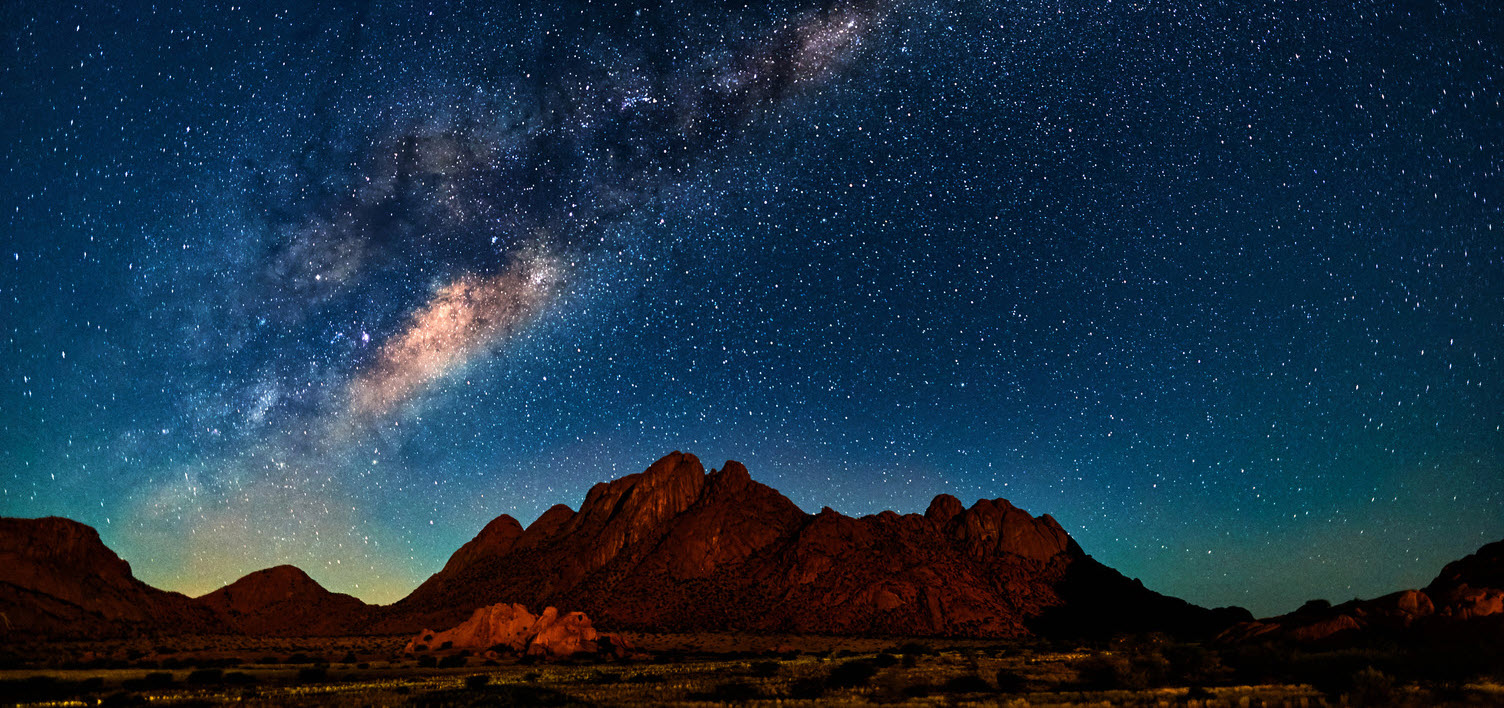
Illustration of the Earth, the sun, and the Milky Way

Award benefits

AGU is proud to recognize our honorees. Recipients of the Charles A. Whitten Medal will receive an engraved medal, as well as the following benefits with the honor:

  • 1

    Awardee will be made an AGU conferred Fellow (if the honoree has been an AGU member for three consecutive years and is not already a Fellow)

  • 2
    Recognition at AGU’s Fall Meeting during the award presentation year
  • 3

    Four complimentary hotel nights during AGU’s Fall Meeting during the award presentation year

  • 4

    Two complimentary tickets to the Honors Banquet at AGU’s Fall Meeting during the award presentation year

Eligibility

To better understand eligibility for nominators, supporters and Whitten Medal Committee members, review AGU's Honors Conflict of Interest Policy.

  • 1

    Nominees: The nominee should be a senior scientist, but is not required to be an active AGU member. They should be in compliance with the Conflict of Interest Policy.

  • 2

    Nominators: Nominators must be active AGU members and in compliance with the Conflict of Interest Policy. Duplicate nominations for the same individual will not be accepted. However, one co-nominator is permitted (but not required) per nomination.

  • 3

    Supporters: Individuals who write letters of support for the nominee are not required to be active AGU members but must be in compliance with the Conflict of Interest Policy.

Looking up to canopy of pine trees
Geodesist using theodolitewhile standing against wind turbine and sunset

Nomination package

Your nomination package must contain all the following files, which should be no more than two pages in length per document. For detailed information on the requirements, review the Union Awards, Medals and Prizes Frequently Asked Questions.

  1. A nomination letter with one-sentence citation (150 characters or less). Letterhead stationary is preferred. Nominator’s name, title, institution, and contact information are required. The citation should appear at either the beginning or end of the nomination letter.
  2. A curriculum vitae for the nominee. Include the candidate’s name, address and email, history of employment, degrees, research experience, honors, memberships, and service to the community through committee work, advisory boards, etc.
  3. A selected bibliography stating the total number, the types of publications and the number published by AGU.
  4. Three letters of support not including the nomination letter. Letterhead is preferred. Supporter’s name, title, institution, and contact information are required.

Recipients

Citation

Earth science is a data-driven field, and Roger Bilham has brought tremendous energy and creativity to the measurement of data to quantify crustal deformation. For decades Roger has led projects to collect geophysical data in far-flung corners of the world, from Ethiopia to Tibet to Venezuela, to name just a few. He capitalized on space-based geodesy technologies as they became available, spearheading the creation of UNAVCO. He additionally left no stone unturned in a quest to collect data to attack key problems in seismotectonics and seismic hazard, from ferreting out traditional surveying data in dusty reports to designing new instrumentation to measure fault creep and fault zone gas emissions. He designs, installs and maintains creepmeters in California and elsewhere, occasionally lamenting the lack of shoveling talents among younger generations. In his international work Roger has worked tirelessly and creatively to support local partners, attacking work that was beyond the capacity of local resources. These projects involved strong, organic elements of capacity development and inclusion: training for international students and geoscience professionals around the world, as well as students in the United States. Roger’s papers have contributed to the understanding of deformation and seismic hazard on the Indian subcontinent, both of which hinge on an improved understanding of the complex collision between the India and Asia plates. Among a long list of contributions, he brought GPS measurements to bear on a debate regarding the role of the Altyn Tagh fault in absorbing Indo-Asian convergence. In his work on seismic hazard, he created one of the most “borrowed” figures I have seen, depicting the earthquake potential along the Himalayan Arc. The broader impacts of Roger’s contributions go beyond consideration of seismic hazard. Roger took science communication to new heights, starring in successful IMAX movies on Everest and Kilimanjaro. These and other documentaries have brought basic geoscience education to audiences in the millions. Roger’s passion for science is infectious, coming across equally clearly on an IMAX screen as in a classroom setting. Among the ranks of today’s geoscientists are some who declared majors after taking Roger’s introductory undergraduate class. Charles A. Whitten was described as “a man of many talents, a superb all-round geodesist,” “a strong advocate for using geodetic surveys to measure crustal motion.” With his breadth and depth of contributions over a career spanning a half century, Roger Bilham is a Whitten Medalist in the very best tradition of this award. — Susan E. Hough U.S. Geological Survey Pasadena, California

Response

Many thanks, AGU, for honoring me with the Whitten Medal. Good heavens! Coincidentally, it was Whitten’s diversity of geodetic investigations that has been the inspiration for most of what I have meddled with in the past half century. My jump-start was being exposed to the humor and electric intellect of Geof King building a laser strainmeter in Cambridge. This was all soldering irons and milling machines. Then one day in 1970 (around 11:27 a.m.), Dan McKenzie and Teddy Bullard and a bunch of us (student riffraff) were discussing ways to quantify continental collision directly. “Surely the Great Trigonometrical Survey of India must have recorded convergence in the Himalaya,” said Teddy. “Anyone willing to go and take a look? Bilham, you don't seem to be doing anything useful.” I was now launched into mainline geodesy. This was all sines, cosines and spherical excess. A few months later (at 4:14 p.m.) Nick Ambraseys gave us a talk in which he uttered the now famous phrase “Earthquake don't kill people, buildings do.” This opened a completely new (and surprisingly useful) scientific window — the effects of earthquakes (and corruption) on people and the numerical investigation of ancient earthquakes. This was all dusty archives and strange languages, blended with brittle steel and weak cement. In Cambridge too I first met Vinod Gaur, who has been a colleague and guide to everything in India since then. This was all tandoori chicken and high-integrity wisdom. My exciting decade at Lamont-Doherty was surrounded by extraordinarily gifted scientists: Scholz, Sykes, Richards, Jacob and Seeber, to name a few. Thanks for all your wonderful insight and encouragement! This was all “let’s-measure-anything-that-moves,” with tide gauges, tiltmeters and creepmeters. And then, suddenly, there was GPS. In 1986 (at about 09:31 a.m.) we formed UNAVCO, which brought me to Boulder, where I was joined by a wonderfully gifted group of graduate students and my colleague Peter Molnar — thank you guys, you deserve this medal, not I! This was all writing proposals and answering the phone. Within the next few decades, we had measured the convergence of the Himalaya, the height of Mount Everest, plate spreading in Iceland and Ethiopia, the eastward velocity of the Caribbean, and slip rates on the Bocono, Altyn-Tagh, Chaman, and San Andreas faults. Holy cow! This was all frequent-flier miles. Not least I thank Sue Hough and those kind colleagues who persuaded the Whitten committee to look me over. Thank you, all, so much! — Roger Bilham University of Colorado Boulder Boulder, Colorado

Kristine M. Larson was awarded the 2020 Charles A. Whitten Medal at the virtual AGU Fall Meeting Honors Ceremony, held on 12 December 2020. The medal is for “outstanding achievement in research on the form and dynamics of the Earth and planets.”


Citation

For innovative applications of GPS geodesy to problems in environmental sensing, the water cycle, geodetic seismology, and crustal dynamics.

Field Photos

Kristine Larson Whitten Medal Field Photo 1 Kristine Larson Whitten Medal Field Photo 2

Video

David Sandwell was awarded the 2018 Charles A. Whitten Medal at the AGU Fall Meeting Honors Ceremony, held on 12 December 2018 in Washington, D. C. The medal is for “outstanding achievement in research on the form and dynamics of the Earth and planets.”


Citation

David Sandwell is the preeminent leader in applying satellite altimetry data to determine the marine gravity field and seafloor topography to elucidate the thermal and mechanical behavior of the oceanic lithosphere. Through his deep knowledge of space-based radar mapping and altimetry he has made fundamental contributions to understanding the form and dynamics of Venus and the icy moons of Jupiter. When satellite radar interferometric imaging of earthquake processes became possible in the early 1990s, David had just the skill set to enter this field and make both methodological and fundamental contributions that continue to this day.

He is a master of detail and thoroughness, and the methods he has developed have become standard. Through his selfless generosity he has made both codes and data sets publicly available for wide use by his colleagues. However, David is not primarily a methods person. For example, he developed powerful interferometric synthetic aperture radar (InSAR) analysis tools to enable insightful research exploring fundamental processes of crustal deformation. These include characterizing coseismic rupture, postseismic relaxation, and the nature of interseismic strain accumulation. He recognized the potential of InSAR to capture both fine details of deformation and broad-scale coverage. His group was the first to develop a plate–boundary-zone-wide InSAR data set spanning the San Andreas fault system that, when integrated with GPS, provided the most comprehensive characterization of distributed deformation along this continental transform zone.

One of David’s greatest accomplishments is becoming a truly outstanding scientist while retaining a healthy work-life balance. He is modest and unassuming, living proof it’s not necessary to be a one-dimensional workaholic to be a successful scientist. He is as comfortable on a surfboard as on a keyboard and makes time for his family and his surfing. He is a positive role model to his students, his postdocs, and his colleagues and has left in his wake a trail of happy collaborators from all over the world.

In summary, David Sandwell has, through is research, placed the fields of marine gravity, planetology, and earthquake deformation on a firm quantitative basis; developed rigorous and innovative new methods; discovered hitherto unknown processes; and trained a cadre of graduate students and postdoctoral scholars who now pursue their own research agendas. The arc of David’s career path and his central scientific contributions are nicely described by AGU’s statement of the qualifications for the Whitten Medal, “outstanding achievement in research on the form and dynamics of the Earth and planets.”

—Wayne Thatcher, U.S. Geological Survey, Menlo Park, Calif.

Response

Thank you, Wayne, for this generous citation, and I also thank the scientists who supported this nomination. This is a real honor for an aging geophysicist with some geodetic skills.

As a graduate student at the University of California, Los Angeles, I was fortunate to study under Jerry Schubert, who taught me the importance of physics-based models; Jerry also encouraged my forays into space geodetic data analysis that were inspired by Bill Kaula, Byron Tapley, Dick Rapp, and many other pioneers. Because of their vision and perseverance, we now have tools such as GPS, radar interferometry, and satellite altimetry to study all types of Earth processes at unprecedented spatial and temporal resolutions; these include plate tectonics, ocean currents, and changes in the cryosphere. The past 3 decades have offered a real data feast for Earth scientists, and I was fortunate to be able to help prepare the recipes and be thrilled by the discoveries. I hope we can improve the tools and research opportunities for the next generation.

I began my geodetic career using radar altimeter data from NASA, U.S. Navy, and European Space Agency (ESA) satellites to study the tectonics of the deep oceans. This was a 20-year collaboration with Walter Smith and several talented graduate students. In the late 1990s I began a new research direction to study continental crustal deformation using radar interferometry (InSAR) and GPS. Wayne Thatcher inspired this conversion by taking a sabbatical to learn InSAR from Didier Massonnet and colleagues at ESA. Howard Zebker, Masanobu Shimada, and others at the Jet Propulsion Laboratory, ESA, and the Japan Aerospace Exploration Agency got us started in the development of SAR processing algorithms that utilize precise satellite orbit methods developed by the altimetry community. Paul Segall, Yuri Fialko, and others laid out the models needed to digest the wealth of crustal deformation data provided by GPS and InSAR. All of this relied on the dramatic increases in computer capabilities that we have witnessed over the past 40 years.

Scripps Institution of Oceanography has provided the stimulating intellectual environment and freedom to participate in basic research as well as to train, and learn from, extraordinary students. Moreover, Scripps has one of the best surfing beaches in the world, and as Wayne mentioned, I have often used a midmorning surfing session to clear my thinking. I thank my wife, Susan, who takes care of most of the practical aspects of our life, and also my family, who have tolerated many absences, both physical and mental, that are typical of scientists.

—David Sandwell, University of California, San Diego, La Jolla

Veronique Dehant was awarded the 2016 Charles A. Whitten Medal at the AGU Fall Meeting Honors Ceremony, held on 14 December 2016 in San Francisco, Calif. The medal is for “outstanding achievement in research on the form and dynamics of the Earth and planets.”


Citation

Veronique Dehant’s research area is the modeling of the deformable Earth’s interior in response to external forcing factors such as the gravitational attraction of the Sun and Moon and the rotational forces associated with the motion of its axis of rotation in space. She extended this research to the solid planets of the inner solar system as well as to the icy satellites of the outer planets. She and her team made groundbreaking contributions in these domains over the past decades.

Firstly, Veronique’s research was centered on the rotation of the Earth in space (precession and nutation) and its strong link with the global structure of our planet. She developed a model of deformable rotating Earth, taking into account all components of the solid Earth and their interfaces. Veronique also studied the effects of mantle anelasticity on Earth tides, the resonances between the liquid and solid inner cores, which led to better understanding of the free oscillations of the Earth and the influence of the geophysical fluids on its deformation and rotation. Further to her work on atmospheric effects on Earth’s rotation she led research within working groups and commissions of the International Astronomical Union (IAU) with the aim of improving knowledge of each component of the deformable Earth system impacted by or impacting the Earth’s rotation. A major outcome of her efforts was the definition of a new nutation model adopted by IAU in 2000. The culmination of decades of work in this area is her book with P. M. Mathews, Precession, Nutation, and Wobble of the Earth (2015).

Veronique has also been very active in making and leading research in planetary geophysics: modeling the interior of Mars, the processes of sublimation and condensation of its polar caps, and its gravity field temporal variations. She applied this approach to Venus and Mercury and to the icy satellites of the outer planets. She proposed a radio science instrument on the ExoMars space mission and was selected as principal investigator. She is an investigator of several missions of the European Space Agency to Mars and Venus (Mars Express and Venus Express), as well as to Mercury (BepiColombo).

For her remarkable scientific achievements Veronique has received several prestigious prizes and is member of several academies. Considering all these and her creativity, her outstanding leadership and services to the community, and her enormous influence in mentoring many junior colleagues, Veronique highly deserves the 2016 Whitten Medal of AGU.

—Georges Balmino, Centre National d’Études ­Spatiales Paris, France

Response

Thank you so much, Georges, for the very generous citation! Thanks also to the colleagues who have proposed me to the Whitten Medal Committee, and its chair, Anny Cazenave, in particular. I am extremely honored and grateful to receive the prestigious Whitten Medal!

I studied mathematics and physics, and I did not anticipate that I would be a researcher in the field of dynamics of the Earth and planets, recognized by the Whitten Medal. I came into the field of Earth dynamics after my master’s degrees in mathematics and physics and thanks to the heartfelt and appreciated mentorship and guidance of Paul Melchior, Paul Paquet, and André Berger from Belgium. Research rapidly became a passion. John Wahr, with whom I had the opportunity to work at the beginning of my career, was a great inspiration to my work.

I then came into the field of planetary science about 15 years ago. This happened when space missions were more and more aiming at understanding internal dynamics of planets. Understanding the evolution of planets has become fascinating to me as well, and I am now preparing an instrument for a mission to Mars, Lander Radioscience (LaRa), aiming at obtaining Mars rotation dynamics and to learn about its deep interior.

More than 10 years ago, I decided to write a book, Precession, Nutation, and Wobble of the Earth, ­coauthored by Sonny Mathews. This was a very nice experience, which allowed me to have the necessary distance to understand where efforts have to be put for the next generation of Earth rotation and orientation models. I decided then to propose the idea of working on coupling mechanisms at the core-mantle boundary for a European Research Council Advanced Grant, which I got. This is very exciting as I am now back to studying Earth in parallel with being principal investigator of a selected space mission, which is very challenging and exciting.

This award wouldn’t be possible without the constant support of the Royal Observatory of Belgium and the great team that I have had the good fortune to work with at the various stages of my career. An invaluable treasure in my life was and is the ongoing support from my beloved family and friends. I praise them for all the good things they have provided for me, and, in particular, Guy, my husband, who transformed my dreams into reality, supporting me over my entire career.

—Veronique Dehant, Royal Observatory of Belgium and Université Catholique de Louvain

Paul Segall was awarded the 2014 Charles A. Whitten Medal at the AGU Fall Meeting Honors Ceremony, held on 17 December 2014 in San Francisco, Calif. The medal is for “outstanding achievement in research on the form and dynamics of the Earth and planets.”


Citation

Paul Segall has contributed to observation, theory, and modeling of earthquake and volcanic processes inferred from surface geodetic measurements. Many practitioners in these fields, including past Whitten medalists, have had an impact on one of these specialist areas. His research on the earthquake deformation cycle has led to new kinematic and dynamical models and analysis methods that extract maximum information from space geodetic data and has shed new light on previously poorly understood earthquake processes. His work has quantified and constrained how volcanoes grow, evolve, and deform, and he has made state-of-the-art space geodetic measurements using models he has himself defined and developed from fundamental principles. Paul has made major contributions in all of them, his work defines where these fields are going, and Paul is their preeminent leader. Since 1990 he has trained a generation of graduate students and postdoctoral scholars, many of whom are now leaders in their fields in academia and government laboratories. His 2010 textbook Earthquake and Volcano Deformation, developed and refined over a decade of teaching, has become an instant classic, an essential reference for all researchers in this field.

Since the mid-1980s, Paul has led his field in modeling and understanding the earthquake cycle, its analysis, and state-of-the-art modeling of seismic processes. From the mid-1980s to the mid-2000s, he tested the prevailing models of earthquake recurrence. Paul and his coworkers developed creative and innovative methods entirely new to the field. These methods were strictly rigorous inversions and statistically defensible methods that showed the recurrence of earthquakes obeyed neither of the popular and prevailing models in use at the time (characteristic, time predictable and slip predictable).

Paul recognized early on significant methodological gaps in analysis of earthquake-related geodetic data. He developed ingenious new methods to extract maximum signal from sparse or incomplete data when the actual candidate models were at least approximately known (the now classic network inversion filter). The method is extremely flexible and versatile and is applicable to classical triangulation data to infer coseismic slip in historical earthquakes as well as to identify anomalies in GPS time series (for example, slow slip events or suspected earthquake precursors).

Paul and his students have developed geodetic methods to innovatively model the large-scale kinematics and dynamics of magmatic extension and intrusion, particularly on Hawaii. This work has shown not only that the south flank of the island is inexorably sliding toward the sea but also that it is driven by magma injection into the rift zones. Previously unknown silent slip events, associated with smaller triggered earthquakes and coupled to the injection events, have been identified.

—Wayne Thatcher, Earthquake Science Center, U.S. Geological Survey, Menlo Park, Calif.

Response

Thank you, Wayne, for the overly generous citation. Thanks also to those who took the time to support my nomination. It’s a particular honor for me to receive this award given the phenomenal group of prior medalists, including my former U.S. Geological Survey (USGS) colleagues Wayne Thatcher and Jim Savage. Charles Whitten himself was the chief geodesist of the U.S. Coast and Geodetic Survey, following in the footsteps of William Bowie and John Hayford. Hayford analyzed the triangulation data following the 1906 San Francisco earthquake, leading to H. F. Reid’s elastic rebound theory. Much later, I had the opportunity to reanalyze these same data, attempting to tease out more information about the 1906 quake, as well as the 1868 Hayward Fault earthquake.

I entered graduate school in 1976 at a time of great anticipation about earthquake prediction and was excited to work on problems with such potential for societal benefit. At Stanford, Arvid Johnson captured my interest and wisely directed me to work with Dave Pollard studying the formation of faults in granite. Following my Ph.D. work, I moved to USGS, where I was impressed with Jim Savage and Will Prescott’s crustal strain program. Following in Whitten’s footsteps, they were measuring strain accumulation on faults, but now with lasers. This struck me as providing unique information for long-term earthquake forecasting and tied in well with my interest in continuum mechanical models of earthquakes. They generously allowed me to work on data from the Parkfield area, beginning my exploration of tectonic geodesy.

Moving back to Stanford gave me the opportunity to work with an amazing group of students and postdocs. Thanks to all of you for helping me explore new Earth processes and learn new analysis methods. I continue to believe strongly that measurements of contemporary deformation, combined with physically consistent models, can contribute to reducing both earthquake and volcanic hazards. GPS and, later, interferometric synthetic aperture radar opened up new opportunities for data collection. What started as an attempt to write lecture notes of sufficient clarity that I could understand them 2 years later led to a textbook on active deformation processes. It’s a real pleasure when students tell me they have found it to be useful.

I’m so fortunate to have the opportunity to work with such outstanding colleagues. Coteaching with Greg Beroza has been both rewarding and informative. Jim Rice has been a generous collaborator and a role model of a scientist and teacher. Thanks, finally, to my friends, including my cycling buddies, and my family and most especially to my wife, Joan, for keeping me grounded.

—Paul Segall, Stanford University, Stanford, Calif.

David E. Smith was awarded the 2012 Charles A. Whitten Medal at the AGU Fall Meeting Honors Ceremony, held on 5 December 2012 in San Francisco, Calif. The medal is for “outstanding achievement in research on the form and dynamics of the Earth and planets.”


Citation

David Smith is a leader in satellite geodesy whose groundbreaking contributions have spanned tectonophysics, geodynamics, and planetary science. Born and educated in Great Britain, he joined NASA’s Goddard Space Flight Center in his early career, where he started the gravity modeling group. There he conceived of and developed Goddard’s GEODYN system of programs, which to this day is considered the state-of-the-art computational tool for satellite orbit determination. Dave was among the first to measure the fundamental parameters of the Earth’s global gravity field, as well as its polar motion and variations in length of day. Measurements of deviations from Earth’s geodetic reference frame that he was instrumental in establishing led to characterization of atmospheric motions, ocean and solid Earth tides, and the viscosity of the mantle.

A second major aspect of Dave’s work has been in measuring directly the motions of Earth’s tectonic plates. He was Project Scientist of the decade-long NASA Crustal Dynamics Project (CDP), an initiative that involved hundreds of individuals at numerous institutions. In this role he

set the tone for how space geodesy should work as a community. The CDP, which utilized very long baseline interferometry and satellite laser ranging, established the surprisingly strong agreement of instantaneous plate drift rates with those over geologic time scales.

Begining in the mid-1980s Dave turned his attention to the planets. He published a gravity field for Mars that was the first high-resolution spherical harmonic model of a planet other than Earth. He led the Clementine geophysics team that produced the first global topography and crustal thickness maps of the Moon. On the NEAR Shoemaker mission, Dave and colleagues produced the firstdetailed three-dimensional view of the shape of an asteroid (433 Eros), and from volume and mass came the first precise estimate of an asteroid’s mean density.

Dave was Principal Investigator of the Mars Orbiter Laser Altimeter (MOLA) that flew on Mars Global Surveyor and produced a global topographic model of Mars that was more accurate than Earth’s topographic model. MOLA established the planet’s flat northern hemisphere as the possible location of an ancient ocean, revealed pathways of past water transport, and yielded the present-day surface water inventory from the volumes of the polar caps. He measured the seasonal accumulation and ablation of Mars’ CO2 snow, as well as gravity field changes due to Mars’ CO2 cycle.

Dave is Principal Investigator of the Lunar Reconnaissance Orbiter’s Lunar Orbiter Laser Altimeter, the first multibeam planetary laser altimeter, which yielded the highest-resolution global topographic model for any planet. On NASA’s MESSENGER mission, Dave leads the gravity experiment that established bounds on internal structure as well as discovering mass concentrations (mascons) on Mercury. He also led experiments that made the longest two-way (24 Mkm) and one-way (87 Mkm) laser links.

Dave’s data sets have led to many scientific discoveries by others. His geodetic grids of the planets have allowed precise geolocation and coregistration of data from other experiments, increasing their value and aiding precision landing of Mars landers and rovers.

Dave Smith’s achievements in terrestrial geodesy or planetary geodesy alone would merit the Whitten Medal; for the combined contributions the case is extraordinary.

–Roger J. Phillips, Southwest Research Institute, Boulder, Colorado

Response

Thank you friends and colleagues for nominating me for this honor. It is humbling to look at the list of previous recipients of the Whitten medal, many of whom I have known well, and realize the array of contributions they have made to this field.

Occasionally, being in the right place at the right time is an essential component for being considered successful in one’s chosen career and this, I feel, has been true for me. When I moved the United States after completing my education at the Universities of Durham and London in England, the discussion of plate tectonics was in full swing. The concept was no longer in doubt but global-scale observations of the kinematics of plate motions was needed to show that it was also a major factor in the cause of today’s earthquakes, and possibly, changes in the Earth’s rotation.

At the same time the development of lasers and their application to measuring large distances was a growing technology and as a result I moved my interest and emphasis from theoretical problems as a mathematician to the acquisition of precise observations to address the broad topic of Earth dynamics. This was a time when space agencies were beginning to appreciate the importance of knowing locations on the planet and I was fortunate to be in the right place and time to be involved in the application of this new field of space geodesy. This was a long-term interest and activity of mine and was the dominant topic of my first 15 plus years in the U.S.

In the early eighties, Bill Kaula, the second recipient of the Whitten medal, said to me it was “about time someone applied those ideas of space geodesy to Mars.” Bill had been at the Goddard Space Flight Center early in his career before moving to UCLA, and I had effectively taken his position at Goddard a number of years later. Again, I was in the right place at the right time in the mid-eighties because the U.S. had just decided it was time to return to Mars. Being selected as an investigator for topography and gravity on the first U.S. space mission to Mars in almost 20 years moved me to planetary geodesy and laser altimetry, and it is where I have been ever since.

This was a great time for many of us as the exploration of the Moon and Mercury were about to begin with the leadership of colleagues and friends, including Maria Zuber with whom I have worked for 25 years and who played such an important role in getting us back to the Moon, Sean Solomon who led us to Mercury and a new view of the inner-most planet, and to Roger Phillips who brought Mars into focus with his thoughts and ideas about the Martian poles and crust. It is a real honor to be awarded the Whitten medal, to have had so much fun, and to have worked with so many outstanding colleagues.

–David E. Smith, MIT, Cambridge, Massachusetts

W. Richard Peltier was awarded the 2010 Charles A. Whitten Medal at the AGU Fall Meeting Honors Ceremony, held on 15 December 2010 in San Francisco, Calif. The medal is for “outstanding achievement in research on the form and dynamics of the Earth and planets.”


Citation

It is a pleasure and an honor to nominate W. Richard (Dick) Peltier for the AGU Charles A. Whitten Medal, which is awarded for outstanding achievement in research on the form and dynamics of the Earth. Dick is an eminent research scholar who has had, and continues to have, a very active, prolific, and creative career, with over 280 refereed publications. He is recognized as one of the most highly cited Earth scientists in the world. His interests are very broad; what is so impressive is that he is so excellent in all of them.

Dick has pioneered work on glacial isostatic adjustments, the associated Maxwell viscoelastic Earth theory, and postglacial relative sea level change. He has made major contributions both to the development of models of Ice Age ice sheet thickness distribution and of corresponding planetary paleotopographies, and to the dynamic mantle response to loading and unloading from the ice sheets. Dick’s work is clearly at the forefront of all these areas; his contributions have been enormous. His models are used widely and are considered by many to be the standard. His current model ICE 5G (VM2) has been independently verified by the Gravity Recovery and Climate Experiment (­GRACE). This problem has high societal relevance currently because of the rebound and subsistence that affect the interpretation of sea level observations.

Dick started his career as an atmospheric scientist and has done extensive work in geophysical fluid dynamics. One of his fortes is the “breaking” of internal waves in the atmospheric jet stream and in the ocean’s boundary currents. It is interesting to note “On the possible detection of tsunamis by a monitoring of the ionosphere,” the 1976 paper by Dick and C. O. Hines (J. Geophys. Res., 81(12), 1995–2000) that examined the concept of using ionospheric disturbances to detect tsunamis. Today, after the Sumatra earthquake and more than 30 years after this paper, this is an active area, especially with Global Positioning System (GPS) technology. Peltier and Hines were certainly ahead of their time.

Dick’s achievements have been recognized by a number of distinctions and awards. A brief but incomplete list includes AGU Fellow, American Meteorological Society Fellow, Sloan Foundation Fellow, Bower Award and Prize for Achievement in Science of the Franklin Institute of Philadelphia (2010), J. Tuzo Wilson Medal of the Canadian Geophysical Union, Patterson Medal of the Atmospheric Environment Service of Canada, Killiam Fellow, Fellow of the Royal Society of Canada, Guggenheim Foundation Fellow, and a D.Sc. (honoris causa) from the University of Waterloo. In addition, Dick has mentored numerous Ph.D. students and postdocs who have carried forward his research and have enlarged his effectiveness and influence. Dick has been generous with his time, serving on numerous committees for the International Union of Geodesy and Geophysics (IUGG), the National Research Council (NRC), the Intergovernmental Panel on Climate Change (IPCC), and others, and acting as an editor for many journals, books, and other publications.

Dick Peltier is a true pioneer in the geophysics community and richly deserves the Whitten Medal. His achievements in research on the dynamics of the Earth and planets are remarkable; his name would add luster to the fine list of previous recipients and truly enhance the prestige of the medal itself.

—JEAN O’BRIEN DICKEY, Jet Propulsion Laboratory, California Institute of Technology, Pasadena

Response

Thank you, Jean, for the effort you’ve invested in nominating me for this honor. I note that the first recipient of this medal, following Charles Whitten himself, was Bill Kaula, a fact that makes this occasion especially meaningful to me, as Bill was a good friend who was very encouraging of my scientific efforts early in my career. My wife, Claude, and I enjoyed many good times with Bill and his wife, Gene, as guests in their home in Los Angeles and at a number of international meetings.

When a nice thing like this happens, it presents an opportunity to reflect on the reasons for one’s good fortune. Jean Dickey has mentioned Colin Hines, my doctoral thesis advisor, in her remarks, and I’m very glad of the opportunity to record my indebtedness to him for the example he set for a young person beginning to work in the area of the geophysical sciences. I was very lucky to have as a role model a person of Colin’s intellect. He and his wife, Bernice, have remained close and valued friends for over 40 years.

I began to develop the theoretical models of the glacial isostatic adjustment (GIA) process, which forms the primary focus of Jean’s nomination, during a postdoctoral fellowship at the Cooperative Institute for Research in Environmental Sciences (CIRES) at the University of Colorado at Boulder. Colin had organized a visiting fellowship for me in CIRES that I was able to take up in the year following completion of my doctoral degree. During the first year I spent in Boulder, to be followed by several subsequent summers, I had the very good fortune to be befriended by W. E. (Bill) Farrell and his wife, Mary, who, as I recall, more or less adopted me! Bill had only a short time earlier completed his own doctoral degree with Freeman Gilbert at the Institute of Geophysics and Planetary Physics (IGPP) at the Scripps Institution of Oceanography.

It was Bill who, aside from introducing me to the glories of extreme cycling in the Colorado mountains, suggested that I might be interested in trying to build a theory of the GIA process using as a basis the work he had completed on the mathematically similar elastic problem of ocean tidal loading. This eventually led to the detailed gravitationally self-consistent viscoelastic theory for ice-Earth-ocean interactions that has proven to be key to the understanding of a wide range of problems in sea level history and the theory of the Late Quaternary ice ages themselves. I was attracted to begin working on this problem, as my doctoral thesis involved theoretical work on the mantle convection process, and analysis of the phenomenology of glacial isostasy provided one of the few means of getting at the issue of mantle viscosity, which is key to understanding this process. The theory that I have developed is now playing an important role in the general area of global change research, specifically in connection to understanding the global sea level rise that is occurring as a consequence of global warming.

I’ve spent my entire career in the physics department of the University of Toronto, aside from sabbaticals at Cambridge University, the National Center for Atmospheric Research in Boulder, and the Institut de Physique du Globe de Paris. At Toronto I continue to be very fortunate to work with a number of gifted young scientists who have contributed greatly over the years to my own understanding of a wide range of geophysical processes.

This is not the first time I have been a beneficiary of the open and supportive nature of the American scientific community, and I continue to highly value my membership in it through this Union. I thank the Whitten Medal Committee of AGU for honoring my work in this way.

—W. R. PELTIER, Department of Physics, University of Toronto, Toronto, Ontario, Canada

Charles C. Counselman III was awarded the 2008 Charles A. Whitten Medal at the AGU Fall Meeting Honors Ceremony, held 17 December 2008 in San Francisco, Calif. The medal is for “outstanding achievements in research on the form and dynamics of the Earth and planets.”


Citation

Rarely does a scientist create an instrument that has a profound effect on a field of research. Chuck Counselman is such an exception. Between late 1978 and 1980, he was the principal inventor and leading developer of methods and systems for determining baseline vectors on Earth with millimeter accuracy, from radio signals broadcast by Global Positioning System (GPS) satellites. Soon baselines thus determined with interferometry were 3 orders of magnitude more accurate than GPS designers had believed possible. Today, GPS receivers embodying Chuck’s technologies are portable, inexpensive, and ubiquitous. Look under the hood and you’ll find many of his basic patents inside.

After initial skepticism, geophysicists saw the dramatic potential of Chuck’s techniques and in droves began applying them to study many aspects of the Earth. The list includes episodic and continuous plate tectonics; crustal deformations due to volcanism and glacial rebound; the flows of glaciers and ice sheets; sea level changes; Earth’s viscosity structure; and much, much more.

Chuck’s contributions were by no means restricted to geodesy. His triple-threat abilities—in theory, experiment, and data analysis—led him far and wide. For his Ph.D. thesis, he elegantly demonstrated the effects of Mercury’s changing orbital eccentricity on its spin-orbit resonance, showing that the probability of capture into this resonance would be markedly enhanced were there a liquid layer between Mercury’s core and mantle. Later, Chuck used differential very long baseline interferometry first to study lunar motions and subsequently to track the Pioneer Venus descent probes to determine the global circulation of the middle atmosphere of Venus.

Chuck excelled as a teacher. His crystal-clear lectures inspired many young scientists to pursue careers in Earth and planetary sciences. As a mentor, he instilled, by example, the drive to find more clever, more accurate, and less expensive solutions to scientific problems. Chuck’s ability to get quickly to their essence was awe inspiring, if a trifle intimidating, to his students and colleagues.

So in partial payment for the debt owed, it is most appropriate that we of AGU have chosen Chuck Counselman to receive this year’s Charles A. Whitten Medal.

—IRWIN SHAPIRO and PETER G. FORD, Harvard University, Cambridge, Mass., Massachusetts Institute of Technology, Cambridge

Response

Thank you, Peter, Irwin, Tim, and the AGU Honors Committee. I am most grateful to my collaborators, especially Don Steinbrecher, Sergei Gourevitch (deceased), Jon Ladd, and Rick Abbot, without whom I could have accomplished very little. I’m also grateful to my mentors Walter Wrigley (also deceased), Irwin Shapiro, Gordon Pettengill, and Alan Rogers; and to my father, who set me on a track leading straight to this stage 65 years ago.

When I was born, my father was teaching Army Air Corps crews to use a new antisubmarine weapon called radar. Without radar, the Battle of the Atlantic and ultimately World War II might have been lost to Nazi Germany. Radar technology so impressed my father that he knew what his son should do, including going to Massachusetts Institute of Technology (MIT), the center of its development.

So I was born to determine the positions of things by radio. I was set on this track with a strong wind behind me. All I had to do was stay on the track.

After World War II, through the cold war and the post-Sputnik space-race years, MIT continued on a roll. When I arrived at MIT in 1960, there was no better place to be.

While I was a student there, the Haystack Observatory was breaking new ground in planetary radar astronomy, and the Department of Geology and Geophysics became the Department of Earth and Planetary Sciences. The new department head, Frank Press, hired Irwin, Gordon, and me, among others.

There was no better place to be. The environment was so fertile that by 1978, when I proposed Miniature Interferometer Terminals for Earth Surveying (“MITES”) to determine position vectors with millimeter-level uncertainties from GPS satellite signals, the necessary engineering development work would be easy. The hard work would be political.

The idea of compact portable instruments determining positions so accurately over long distances was almost universally rejected. Prominent engineers and scientists explained why it was impossible, and a U.S. government official denounced it to the International Association of Geodesy and the International Union of Geodesy and Geophysics as “snake oil.”

Fortunately, Don Steinbrecher and I were able to muster resources privately to build a system that proved the concept. Jim Collins (retired from the National Geodetic Survey) and Jon Ladd (for-merly with Western Geophysical) joined us; and Don Eckhardt and Ted Wirtanen convinced the director of the Air Force Geophysics Laboratory to support construction and deployment of a second-generation system. Buck Mateker initiated and led Litton Industries’ development and deployment of further generations; and John Bossler’s National Geodetic Survey adopted our third-generation systems.

Our methods and systems found their way into all but one of the many geophysical applications I proposed in 1978 (even the monitoring of ice flow), and of course into others I never imagined. I’d nearly forgotten this ancient history and was amazed to hear from Tim Killeen that anyone else remembered it and that I’d been selected as a Charles A. Whitten medalist. Believe me, the elapsed time has greatly compounded my joy. Thank you again, all of you.

—CHARLES C. COUNSELMAN III, Massachusetts Institute of Technology, Cambridge

John M. Wahr was awarded the Charles A. Whitten Medal at the AGU Fall Meeting honors ceremony, which was held on 13 December 2006 in San Francisco, Calif. The medal recognizes outstanding achievement in research on the form and dynamics of the Earth and planets.


Citation

It is a pleasure and an honor to present the citation to John M. Wahr for the Charles A. Whitten Medal, which is an award for outstanding achievement in research on the form and dynamics of the Earth. John has made fundamental advances in many areas of dynamics, including time-variable gravity, Earth rotation, Earth and ocean tides, interaction of the atmosphere and ocean with the Earth, postglacial deformation, and nutation. He has published papers in geodesy, geodynamics, seismology, geomagnetism, hydrology, cryospheric sciences, oceanography, atmospheric sciences, planetary sciences, and even general relativity.

John is a major intellectual leader in much of geophysics with a heavy emphasis on global-scale problems involving the fluid envelope. John broke new ground with his work in the application of geodetic data to geophysical problems, including global tides, barometric response of the oceans, and Earth rotation. His unique contributions came from developing the theory, and modeling Earth tides, nutations, and various other types of rotational and deformational motion. Both the Earth tide model and the nutation model served as the adopted international standards for almost 20 years. His cutting-edge work on time-variable gravity has enabled him to blaze a new trail for interdisciplinary geodesy.

s chair of the U.S. National Research Council Committee on Earth Gravity From Space, I know well the strengths of his insights, and his tremendous ability to work across disciplines with great collegial enthusiasm. The committee’s report, “Satellite Gravity and the Geosphere: Contributions to the Study of the Solid Earth and Its Fluid Envelopes,” contains an unusually large amount of original research that has application to a broad range of disciplines, including solid-Earth geophysics, oceanography, glaciology, meteorology, and hydrology. His hard work and creativity contributed greatly to an exceptional report and to the selection of a dedicated satellite gravity mission (the first one in over two decades!).

He is truly a role model for the AGU motto, “unselfish cooperation in research.” John has been a ‘guiding light’ for GRACE [Gravity Recovery and Climate Experiment] applications and a ‘prime mover’ in bringing to bear the remarkable new data and spreading the good news to our sister fields including hydrology, glaciology, and oceanography. With 25 coauthored GRACE journal articles, he along with his colleagues have measured mass loss in Greenland and Antarctica and examined global ocean mass and terrestrial water storage variations.

John’s achievements have been recognized by a number of medals and awards. His work and his potential were noted quite early in his career; he is the recipient of both the prestigious AGU James B. Macelwane Award and the International Association of Geodesy (IAG) Bomford Prize for geodetic research. He is both an AGU and IAG fellow; in 1998, he was the first recipient of the Vening Meinesz Medal from Utrecht and Delft Universities. Subsequently, the Vening Meinesz Medal was established by the Division on Geodesy, European Geosciences Union (EGU), as an award for distinguished research in geodesy; in 2004, John received the Vening Meinesz Medal again, this time from the EGU. In addition, John has mentored 17 Ph.D. students and seven postdocs who have carried forward his research and have enlarged its effectiveness and influence.

John Wahr is a true pioneer in the global geophysical community and richly deserves the Whitten Medal. His achievements in research on the dynamics of the Earth and planets are remarkable and have enabled entirely new fields of interdisciplinary investigation. His name adds luster to the fine list of previous recipients and truly enhances the prestige of the medal itself.

—JEAN O. DICKEY, Jet Propulsion Laboratory, California Institute of Technology, Pasadena

Response

I am delighted to receive the Charles A. Whitten Medal. I am indebted to Jean and others who took the time to do this, and to those who, especially early in my career, made sure I was on the right path.

I pretty much stumbled into geophysics by accident. I was a first-year physics graduate student at Colorado, trying to decide what sort of physics to do, and trying desperately to avoid teaching freshman physics recitations. So I took a temporary research position with Pete Bender to work on a proposed Mercury orbiter mission. Pete introduced me to the world of geophysics, which looked to be a whole lot more fun than whatever it was I had in mind at the time. He eventually directed me across campus to work with Martin Smith on modeling tides and nutations and other solid Earth things.

Martin was an exceptional and generous advisor, who gave me all the tools I needed to solve my problem, and then let me take all the credit. Afterward he sent me on to Princeton where I was a postdoc at the Geophysical Fluid Dynamics Laboratory. There I got to interact daily with many exceptionally talented people, especially Tony Dahlen and Bram Oort, and where I discovered that the more fluid parts of the Earth were interesting too. From there I got to go back to Colorado, where it’s wonderful (just as many people suspect) and where I am today.

There are many great things about having an academic career in science. The most satisfying thing for me has been the opportunity I’ve had over the years to work with so many talented and energetic students and postdocs. To them, and to the many collaborators and colleagues I’ve had the pleasure to work with over the past couple decades, I’d like to say that, at least for me, it’s been a lot of fun. And I thank them for that.

—JOHN M. WAHR, University of Colorado, Boulder

Wayne Thatcher received the Whitten Medal at the 2004 Fall Meeting Honors Ceremony on 15 December, in San Francisco, California. The medal is given for outstanding achievement in research on the form and dynamics of the Earth and planets.


Citation

Armed with geodesy, Wayne Thatcher has probed the behavior of great earthquakes, concentrating on the two sites where large events are frequent and the geodetic record is lush: the western United States and Japan. From this, he has garnered deep insights into the earthquake cycle—the pattern of strain accumulation and release of which an earthquake is only the most visible part.

Building on the work of H. F. Reid, who in 1910 gave us the elastic rebound theory of earthquake occurrence, Thatcher was the first to use geodetic measurements to analyze variations in strain throughout the earthquake cycle. Using data from repeated triangulation surveys, he mapped the strain released in the 1906 San Francisco earthquake and the subsequent strain accumulation. Remarkably, these data had been little studied since Charles Whitten established many of the networks in the 1930s to 1950s. Combining these measurements with elastic dislocation theory, Thatcher found that the 1906 earthquake was surprisingly shallow—470 km long but just 10 km deep.

Thatcher first identified accelerated strain following the 1906 earthquake, which he ascribed to slow slip beneath the rupture. He further demonstrated that the maximum shear-strain rate decayed exponentially since 1906, and that the strain concentration at the fault broadened with time. Decades after initial publication, we continue to rely on these papers to address questions raised by the 1906 earthquake, its influence on events like the 1989 Loma Prieta shock and other Bay Area earthquakes, as well as present-day seismic hazards in the San Francisco Bay area.

Wayne’s collaborative work on the earthquake cycle in Japanese subduction zones has shaped our thinking about megathrusts. Thatcher was the first to show evidence for short-term transient deformation near subduction zones, which he suggested was due to after-slip; and longer-term transients, which he argued were caused by viscoelastic relaxation of the asthenosphere underlying the elastic crust. Differentiating between what Wayne coined as the “thin lithosphere” and “thick lithosphere” models of postseismic deformation continues to be a first-order objective of research. Recent research by Thatcher and his colleagues on postseismic measurements suggests that the crust is stronger than the ductile uppermost mantle where relaxation is focused.

Wayne was quick to embrace space-based geodetic methods and their promise of enhanced precision and density. His GPS transect across the Basin and Range province for the first time provided direct measurements of the distribution of strain within the region, showing that strain is concentrated in just a few active belts near the edges of the Great Basin. He has also established a strong USGS program using satellite radar interferometry (InSAR) to image deformation around magmatic systems and active faults in the western United States, working with USGS colleagues to uncover unexpected mobility of magmatic systems and to place better constraints on postseismic processes.

In a sense, Wayne’s most recent work largely answers the thin-versus-thick lithosphere conundrum he posed at the outset of his career: The higher-quality data now available suggest that a mobile upper mantle plays a very significant role in driving observed postseismic deformation. At the same time, an attribute that has marked Wayne’s career from its inception and has never wavered is that he resists the temptation to overstate his findings, never presents his views as incontrovertible, remains open to new ideas, and is always excited by what’s coming next.

—ROSS STEIN, USGS, Menlo Park, Calif.

Response

I thank you, Ross, for your generous citation, and I’m honored to receive this recognition from AGU. It is most gratifying to me that colleagues and friends like Ross and Paul Segall saw fit to nominate and support me—no one ever receives such an award without these essential, selfless actions. Of course I am pleased to receive it, too, but for me the scientific life has always been its own reward. I’ve always felt lucky to have colleagues who are both supportive and demanding, and I’ve been fortunate to spend most of my working life at the U.S. Geological Survey, where good science is encouraged and respected. It should go without saying that any individual award owes more than a little to valued colleagues and a tolerant institutional environment.

The plate tectonic revolution occurred while I was a grad student, and like many of us in solid Earth science my subsequent research has often been focused on mining its consequences and implications. In my specialty, tectonic geodesy, two broad topics have guided my work: (1) the earthquake deformation cycle at major plate boundaries; and (2) continental deformation and plate tectonics. Soon after finishing my Ph.D., I was distracted from seismological research by an underexploited century-long record of classical geodetic measurements—triangulation and leveling—that provided important constraints on the deformation cycle at strike-slip plate boundaries in California and subduction boundaries in Japan. The inventions of space geodesy during the past 15 years led me to the second topic, because GPS methods are the perfect tool for quantifying the deformation of the continents and are now finally beginning to address issues that have remained unresolved since the late 1960s. GPS and InSAR methods are also providing spectacular refinements in our knowledge of the earthquake cycle and many surprises about the restless behavior of magmatic systems.

As mentioned above, I’ve been fortunate with my colleagues and coworkers. Though the list is inevitably incomplete, I wish especially to thank my thesis advisor, Jim Brune; my colleagues Jim Savage, Tom Hanks, John Rundle, Ross Stein, Paul Segall, David Hill, Philip England, and Fred Pollitz; and the marvelous group of postdocs who have worked with me over the past decade: Takeshi Sagiya, Chuck Wicks, Gerald Bawden, Takuya Nishimura, Bill Hammond, and Marleen Nyst. They’ve all taught me a lot, made science fun, and, when necessary, taken me in hand and held me to a high standard. In the matter of standards, I’ve tried to hew to the principles described by English Nobel laureate Peter Medawar in his Advice to a Young Scientist (1979). In particular, he said, “It is no kindness to a colleague—indeed it might be the act of an enemy—to assure a scientist that his work is clear and convincing…” [if one’s opinion is otherwise]. So I’ve always encouraged those whose judgment I respect to be completely candid in sharing their views on my work. They have been—how shall I put it?—extremely enthusiastic, in honoring this earnest request. However ego deflating and even painful this may have been at times, such open criticism has been immeasurably important in my career.

Indeed, one may argue that it is essential to the success of the scientific method. Finally, I want to especially thank my wife, Mary Ellen, and son, Iain, who have not only put up with me and endured the time-intensive rigors of my scientific life, but also encouraged and supported me in this strange passion.

—WAYNE THATCHER, USGS, Menlo Park, Calif.

Byron D. Tapley received the Charles A. Whitten Medal at the 2001 Fall Meeting Honors Ceremony on 12 December in San Francisco, California. The medal recognizes outstanding achievements in research on the form and dynamics of the Earth and planets.


Citation

“The Charles A. Whitten Medal ‘recognizes outstanding achievements in research on the form and dynamics of the Earth and planets.’ Professor Byron Tapley is truly deserving of this prestigious award.

“For more than four decades, Byron Tapley has been an educator, a researcher, and a visionary who has made unique and significant contributions to advancing the field of space geodesy into an interdisciplinary branch of Earth and planetary science. The evolution of the field called geodesy, defined in the nineteenth century as the science ‘that measures size and shape of the Earth,’ into the discipline that now also ‘measures the changes of the size and shape of the Earth and the planets,’ is owed to a few pioneers who have been developing geodesy into what it is today. Byron Tapley is among the elites who have pioneered this interdisciplinary science in space geodesy, which is now routinely associated with contemporary problems in geodynamics, geophysics, oceanography, and climate change.

“He is cited for his innovative applications of statistical orbit determination and satellite dynamics theory to pioneer and advance the discipline of modern satellite geodesy for interdisciplinary Earth science. Here I will highlight only a few of his many scientific accomplishments.

“Byron Tapley’s early significant contribution, in the 1970s, was his elegant statistical formulation of the nonlinear precision orbit determination and geodetic parameter recovery problem to exploit increasing accurate data collected by planet-orbiting artificial satellites, which began to be available since the advent of the space age. This pioneer work helped create science and application areas such as Earth and lunar mission orbit determination, navigation, positioning and time transfer, reference frame realization, and geophysical and geodetic parameter recovery such as Earth rotation, gravity fields, tides, etc. A recent example is the application of this technique for accurately measuring the position of the TOPEX/POSEIDON satellite, 1300 km above the Earth, to 1-2 cm radially.

“This one-part-per-billion measurement enables the applications of the inferred sea surface height from satellite altimetry for scientific studies, including the now-routine monitoring of El Niño and La Niña phenomena and the study of general ocean circulation and global sea-level change.

“During the 1980s, the development of precise satellite laser ranging (SLR) systems enabled a number of interdisciplinary sciences to be studied with highly accurate measurements for the first time. They include the determination of tidal deceleration of the Moon, absolute tectonic plate velocities, crustal deformations, the measurement of secular change of the Earth’s zonal harmonics (i.e., ‘the Earth getting rounder due to ice melt which started since the last ice age 18,000 years ago’), and its constraint to Earth’s mantle viscosity and Earth’s meltwater budget.

“Even in the presence of the current GPS global network with ever-increasing use of GPS stations, SLR remains a critical and necessary technique for its sensitivity to the geocenter and its contribution to realization of the global terrestrial reference frame.

“Byron Tapley has contributed to the initial establishment of the first global SLR network in support of NASA’s Crustal Dynamics Project. Byron Tapley is among the group who first published the observed J2-dot from SLR to Lageos and the use of the observation to constrain the planet mantle viscosity.

“During the 1990s, in addition to the contribution as the leader of the TOPEX/POSEIDON Precision Orbit Determination Team, Byron Tapley contributed to the contemporary determination of Earth’s gravity field model, especially for the theory and applications of satellite data. The resulting gravity field model solution was used to compute precise orbits of TOPEX/POSEIDON, and the methodologies developed have benefitted subsequent gravity model developments, for example, EGM-96 and TEG-4; and will influence future model developments.

“During the late 1990s, Byron Tapley as the Principal Investigator provided leadership to enable the approval of the first-ever gravity mapping mission, the U.S.-German GRACE mission, which will be flown in 2002. GRACE will provide revolutionary measurements from space for mass motions at the surface or subsurface with an anticipated accuracy of less than 1 cm of fluid movement. These measurements manifest in the form of time-varying gravity field and is contributed by the complex solid Earth-ocean-atmosphere-hydrosphere-cryosphere processes within the Earth system. It has been widely accepted that many of these signals are climate change-sensitive and are critical for studying global climate change.

“Byron Tapley’s contribution to the interdisciplinary field of satellite geodesy is diverse. He is among the elites who have brought this branch of science to be one of the foci of contemporary problems in geophysics. It is my pleasure to have known Byron for over 25 years as a former student and colleague and to be able to describe some of his many accomplishments for which he is awarded the Whitten Medal from the American Geophysical Union.”

—C. K. SHUM, Ohio State University, Columbus

Response

“Thank you C. K. for your generous remarks.

“I am especially pleased to receive this award, not just because of its Union significance, but also because of my previous contact with the individual for which it is named. The broad vision and keen insight possessed by Charles Whitten, along with the enormous contributions that he made to our field, add a special significance to the award.

“I have been very lucky to participate in the exciting transition in geodesy, which has occurred during the past few decades. During this period, geodesy has moved from a predominately regional observation-based science, focused on stationary phenomena, to a science whose framework is global and one in which the temporal changes have become as important as the mean properties. The development of space geodetic techniques allows accurate global measurements with comparatively short campaigns and provides the capability to repeat these measurements as needed. These techniques have transformed geodesy from an essentially observational science to one in which the interpretative phase, in an interdisciplinary context, is of equal importance. To participate in this transformation has been a pleasure and a privilege.

“In accepting this award, it is important to recognize that it is symbolic of the contributions of numerous colleagues and very bright students with whom I have interacted. I have had the good fortune to learn a great deal from both and for this I am very grateful.

“My commitment to the space geodesy field began one morning in the summer of 1977 with a telephone call from George Born, who at that time was at JPL and was responsible for the orbits for the planned SeaSat mission. The mission had a radial orbit accuracy requirement of ten centimeters and the best orbit accuracy achievable at that time was between two and five meters, mostly limited by knowledge of the Earth’s gravity field. George was seeking a lead for an experiment team to implement the first space-based GPS receiver, as a means of obtaining some portion of the two-order magnitude improvement in orbit accuracy that was needed to support the altimeter measurements. This sounded like an interesting extension to my concern with the satellite orbit determination problem and I agreed to the assignment. This decision set a course that is still ongoing and has influenced the efforts of numerous associates and students. The GPS receiver development was troubled and eventually was dropped from the SeaSat instrument complement, only to resurface for all following satellite altimeter missions. I moved on to the lead of the POD/Altimeter Team, where a mixture of radio and optical measurement systems were involved. Although SeaSat lasted only ninety days, the potential for satellite altimeters was demonstrated and the requirement for the following altimeter missions, with the improved tracking and POD approaches and better gravity models, was set. These requirements became major drivers of the space geodesy community during the subsequent decades. The MOBLAS SLR systems, which were base lined as one of the primary systems for tracking SeaSat, were not deployed prior to the satellite failure, but they became the tracking backbone for the altimeter missions during the following decades and for supporting the measurement goals of NASA’s Crustal Dynamics Project.

“The combination of Doppler and SLR tracking along within an extensive community effort to improve the gravity and surface force models provided the basis for the two order magnitude orbit accuracy improvement achieved for the TOPEX/POSEIDON mission. The success in attacking the numerous problems related to meeting the challenging requirements for precise point positioning, whether a satellite in orbit or a point on the Earth’s surface, has been achieved through the contributions of a number of collaborators.

“In the interest of time, I would limit specific recognition to those individuals with whom I have had more or less daily contact. In addition to George Born, these include Bob Schutz, John Ries, C. K. Shum, Mike Watkins, Srinivas Bettadpur, and Richard Eanes. They have been an essential part of the overall effort and share in the success achieved.

“On a personal basis, I would like to recognize the importance of my family. My wife Sophia and our sons Mark and Craig are able to be here tonight. Throughout this period, Sophia has been a valued companion and a point of stability in an otherwise dynamic and sometimes stressful environment. She has endured the long hours and let many of her personal pursuits lag to participate in my commitments. The affection, support, and wise council that she has provided have been a very important ingredient in any measure of success that I have achieved. I am especially pleased that she is here tonight. I am also happy that Craig and Mark could be here. As much as Sophia and I were pleased and amazed by them as children, the interaction with them as adults is even more rewarding.

“In closing, I would like to express my appreciation to the Union, and to my colleagues within the Union, for this award. I trust that our future interactions will be as rewarding as those of the past.”

—BYRON D. TAPLEY, University of Texas, Austin

Richard I. Walcott received the Charles A. Whitten Medal at the 2001 Fall Meeting Honors Ceremony on 12 December in San Francisco, California. The medal recognizes outstanding achievements in research on the form and dynamics of the Earth and planets.


Citation

“In the 19th century, geodesy—the measurement of the shape of the Earth—became the first part of the Earth sciences where rapid progress became possible through accurate measurement. The group who first exploited this technique on a large scale was the Indian Survey, based at Dehra Dun. Its measurements in India led to the idea of isostasy, but the group’s influence was much greater: the people it trained went all over the world making accurate geodetic measurements and thinking about the results. For a long period the survey’s research dominated the development of geodynamics and is now slowly doing so again. One of the people who has brought about this recent change is Dick Walcott, and it is partly for this reason that he is the recipient of the 1999 Charles A. Whitten Medal.

“Dick’s early research for his Ph.D. concerned the geology of the Red Hill complex in New Zealand, an ophiolite complex cut by the Alpine Fault. The origin and emplacement of such complexes have long puzzled petrologists, and his work was carried out shortly after the association of such structures with oceanic crust had been recognized. However, field studies of ophiolites are notoriously difficult, and Dick left this field when he moved to British Columbia, Canada, as a postdoctorate in 1966. A year later, he moved to the Dominion Observatory in Ottawa, where he stayed for 8 years until he returned to New Zealand in 1975.

“I first met Dick at this time, when I visited the observatory. He was working on one of the classical geophysical problems of interest since the 19th century: lithospheric flexure. Dick had realized that this subject was central to understanding how plates could move. What particularly interested him was the gravity signature of flexure, and he used this to estimate the elastic thicknesses of continental and oceanic plates. His early estimates of flexural rigidity, made in the space domain, have been confirmed by studies using the much larger data sets now available and spectral techniques in the frequency domain as well as space domain modeling. These studies have confirmed the accuracy of Dick’s early estimates, which showed how thin the elastic layer is that is responsible for the rigid motion of the plates.

“In 1975 Dick returned to New Zealand and again changed the direction of his research, this time to one that every geodesist would recognize as geodesy! The plate boundary between the Australian and Pacific plates crosses New Zealand, and the relative motion of these plates is responsible for the seismic activity and quaternary deformation that is such a striking feature of the country. When Dick returned, he started a major project to understand how this deformation was related to the motion of the plates on either side. There are a number of reasons why New Zealand is a good place to carry out such a study. It is one of the relatively few places where continental tectonics occurs between plates whose velocity is known from oceanic spreading rates. In addition, 19th century geodesists, trained in India by the survey, had surveyed the islands with extraordinary care and accuracy. But perhaps the most important reason is that there was a small group of outstanding Earth scientists and geodesists in the Wellington area of New Zealand, all of whom Dick knew well. So he did not have the problem faced by most geologists and geophysicists in other parts of the world who wished to use geodetic measurements for tectonic purposes—namely, convincing the geodesists that the movements are real and not the result of surveying errors. What Dick and his colleagues found was that the deformation was distributed over a wide region as it crossed New Zealand and also that it involved rotations as well as translations. In a beautiful use of yet another field of geophysics, he then used paleomagnetic measurements to demonstrate the existence of these rotations. He is now exploiting the new space-based geodetic techniques, and especially the Global Positioning System, to examine the deformation in more detail.

“Dick’s research involves geodesy in its widest sense. He is one of a very small band of people who has brought the subject back to its rightful place at the center of geophysics. It is fitting that his great contribution to our understanding of tectonics should be honored by the Charles A. Whitten Medal.”

—DAN P. MCKENZIE, University of Cambridge, England

Response

“The award of the Charles A. Whitten Medal has a particular pleasure for me, as I enjoyed meeting Charles at several AGU meetings. He took a serious interest in the research activities of the time, particularly those involving survey data with which he was familiar, and he was invariably helpful and supportive. I thank the AGU for the award and this opportunity to acknowledge debts to several people.

“Earlier this year, Harold Wellman died in Wellington. He was the most eminent geologist of this century in New Zealand and, by far, the dominating personality in the Geology Department at Victoria University where I studied. He was noted for a number of major contributions; the stratigraphy of the New Zealand Cretaceous and the discovery of the Alpine fault as a major continental strike-slip fault are examples. But to my mind, his most important characteristic was his quantitative approach to geological deformation, which probably came about through his earlier training as a surveyor. To Harold, description was not explanation—an uncommon geological view of the time—and my interest in the measurement of Earth deformation by whatever means was something acquired from him. In 1967 I obtained my first job with the Gravity Division of Energy Mines Resources Canada in its systematic gravity mapping of the country, and an inevitable problem of interpretation of gravity was the nature of the compensation for topographic loads. It was the very different behavior of the Earth in northern Alberta compared to the Basin and Range Province that focused attention on the problem of flexure. Surfaces underlying the flat-topped Caribou Mountains in Alberta showed no deflection because of their very substantial load, yet if the Earth behaved the same way as Crittenden had described for Pleistocene Lake Bonneville, we would expect to see a downward flexure of several kilometers. Because this was not so, the lithosphere had to support the load and spread the compensation and thus be many times stiffer under the Interior Plains of Canada. From that conclusion it was natural to proceed to estimating the stiffness of the lithosphere in other examples of surface loading.

“I returned to New Zealand in 1975 and joined Hugh Bibby in extending his earlier work on measurement of shear strains from reobservations of old surveying networks. Repeated triangulation estimates of deformation resulting from earthquakes were common in New Zealand and elsewhere, but with the instruments then available, only changes in angles could be determined with accuracy so that the displacement vector of any particular trig point could not be obtained. However, as F.C. Frank showed, the shear-strain components of the deformation of any triangle could be unambiguously measured. Hugh had showed that repeated triangulations could indeed give sensible shear-strain estimates in an area of rapid tectonic deformation and, importantly, that the triangulations need not be of highest geodetic standard; old surveys, although not of great accuracy in themselves, could provide excellent estimates of the deformation because of the long period between repeated surveys. It was clear that abundant information already existed in national archives to obtain extensive coverage and thus map the rate and direction of relative displacements during the intervening period. With mapped shear strains it was possible to estimate the kinematics of the deformation. Thus it was shown that the current rate of deformation across the Pacific-Australian plate boundary through New Zealand had the same sense, rate, and direction as that predicted by the Euler vector describing relative plate motion on a geological timescale.”

—RICHARD I. WALCOTT, Victoria University of Wellington, New Zealand

Gordon H. Pettengill was honored as the recipient of the Charles A. Whitten Medal at AGU’s Spring Meeting in Baltimore on May 28, 1997. The award is given for outstanding achievements in research on the form and dynamics of the Earth and the planets. The citation and Pettengill’s response are given here.


Citation

“‘Rock solid’ is the best description of Gordon Pettengill’s research. Always in the forefront, never trivial, Gordon’s publications set the highest standards for scientific content and clarity of presentation. His preparation was equally solid, from an undergraduate physics education at the Massachusetts Institute of Technology to graduate school in physics at the University of California, Berkeley, with only a brief interlude partly spent in Europe in 1944-1945 settling a certain conflict there.

“The common thread through almost all of Gordon’s research is radio or, more specifically, radar. His experiences as a radio ham during his youth helped give Gordon a firm grasp of the nuts and bolts; theoretical underpinning followed in his formal education, with sophisticated applications being the hallmark of his subsequent research. Throughout, Gordon has been the antithesis of a `fuzzy thinker’; when he speaks or writes, his statements can be relied upon to be backed by careful, rigorous thinking.

“Let me note just a few highlights of his contributions. Gordon’s career blossomed in the space age. He was the driving force behind using the then-new Millstone radar at the MIT Lincoln Laboratory for the earliest work in radar astronomy. When it became operational in late 1957, Gordon used this radar to `skin track’ Sputnik I, the first such observation of a satellite. His earliest research extending well beyond the Earth’s environment was with this same radar in 1961; he used it to make the first ranging measurements to another planet, Venus, to which he would return with even more distinction later in his career. These first observations yielded a value for the astronomical unit in terrestrial units which has stood the test of time and has an accuracy some 3 orders of magnitude greater than had been possible with the armamentarium of classical positional astronomy. Such knowledge was critical for the successful navigation of Mariner 2 to Venus.

“Gordon first became famous for observations closer to home: the successful two-dimensional radar mapping of the Moon in 1960, a key step in the U.S. preparations for the Apollo program, insuring, for example, from follow-up data, that the Apollo astronauts would not disappear under a meters-thick layer of dust.

“Gordon went to the Arecibo Observatory in the early 1960s and was largely responsible for its use as a radar astronomical tool. Most notable from this phase of Gordon’s work was the spectacular discovery that Mercury’s spin period was about 59 Earth days, not the 88 days that had been widely believed for nearly a century. In typical Gordon fashion, he had realized that despite the 88-day period’s having been `confirmed,’ the evidence in favor of this period was not all that secure, and he planned to make definitive measurements using the delay-Doppler technique as soon as the Arecibo radar could be instrumented for such observations of Mercury. His `nose for an important problem’ was more than amply rewarded. This discovery led to Giuseppe Colombo’s realization that Mercury was in an unexpected 3:2 spin-orbit resonance and to a subsequent renaissance in the study of dynamical resonances in the solar system.

“Later in the 1960s and early 1970s, Gordon led ground-based radar studies of the surface properties of all of the inner planets, including the Earth’s (via a clever `triple-bounce’ experiment: Moon-Earth-Moon). Gordon also played a leading role in the first radar studies of an asteroid (Icarus, in 1968), a comet (Encke, in 1980), and moons of other planets (the Galilean satellites, starting in 1976). In all of this work, Gordon made use of radar systems at MIT’s Haystack Observatory and Cornell’s Arecibo Observatory, systems whose development he had guided for astronomical applications.

“Over the last two decades, Gordon returned to an early love, concentrating most heavily on Venus, this time utilizing radars aboard spacecraft, first the Pioneer Venus Orbiter and most recently, Magellan. Because of Gordon’s actions spanning the broadest political fronts to the narrowest technical details, the former was a spectacular success, only to be overshadowed by the latter. For many years, he pursued with vigor, intelligence, and perseverance the idea for using a radar altimeter to map Venus. He also contributed key technical ideas and corrected many errors of contractors along the way. It is hard to overestimate the importance of the incredible attention Gordon gave to every detail that resulted in these superbly functioning radar instruments. The results, in part, were detailed reflectivity and topographic maps of virtually the entire planet of Venus, providing geologists and geophysicists, for example, with lifetimes of work to understand the development of Venus’ crust and the history of its interior. The one individual that many planetary scientists feel is most responsible for our present knowledge of Venus (aside from its atmosphere) and for the puzzles it presents is Gordon.

“As he goes through middle age, Gordon has been turning some of his talents toward theory. In a remarkable piece of analytical detective work, he developed a model to explain the anomalous monostatic and bistatic radar scattering properties of Venus’ highest land, Maxwell Montes – a thin layer of the rare Earth metal tellurium.

“I am also happy to report that Gordon has an excellent heredity, and with his razor-sharp mind, I expect that he will be making unexpected fundamental contributions to planetary science for at least another two decades (he is currently involved in altimeter experiments aboard the Mars Global Surveyor mission, now underway).

“It has been my pleasure to have known Gordon for over 40 years as a dear friend as well as a close colleague; there is no one I admire more. It thus gives me great pleasure to be able to describe some of the accomplishments for which Gordon is receiving the Whitten Medal of the American Geophysical Union.”

—IRWIN SHAPIRO, Harvard Smithsonian, Center for Astrophysics, Cambridge, Mass.

Response

“Thank you, Irwin; I feel very honored and flattered to have been awarded the Charles A. Whitten Medal! It is a particular pleasure to have you as citationist, since our professional and personal paths have crossed and paralleled each other so often over the last four decades. Even 43 years ago, while I was observing the scattering of high-energy protons as a graduate student at Berkeley, you were working out theoretical aspects of the same problem (unbeknownst to each other) at Harvard. Since then, our work has taken both of us far afield, from the nuclear force to radio frequencies at the opposite reach of the energy spectrum.

“In his response to receiving the 1996 Bowie Medal at last fall’s AGU, Gene Shoemaker remarked on the lucky accident of being in the right field and the right place at the right time. I owe a similar debt to the gods of chance! At Berkeley (and earlier at Los Alamos), I felt like a very small fish in a very large pond: in those days just after World War II, nuclear physics was thought to be at the cutting edge of scientific research, and all the brightest people seemed to be elbowing their way into it. Part of my motivation in moving back east in 1954 and joining the Massachusetts Institute of Technology’s Lincoln Laboratory as a newly fledged Ph.D. was to get into a younger and less mature field where there might be less competition. I remember my employment interview with the then director of Lincoln, where I voiced my hopes of becoming involved with spacecraft exploring the solar system only to be rebuffed with: “`you don’t believe in that Buck Rogers stuff, do you?’” Fortunately, my remarks were not held against me, and they hired me anyway! Moreover, Buck Rogers indeed soon became one of the icons of space exploration, following the launch of Sputnik a few years later.

“Those were the glory years, when the military seemed willing to spend endless sums of money to explore new technical avenues for defense, and if useful science could be done along the way that was just great! The thinking was that exercising the new toys this way might help in their teething process! So exercise we did! Even the 1000-ft. Arecibo telescope that came along 10 years later in 1964 was initially built with military (ARPA) money in order to study the properties of the upper levels of the ionosphere, which could not be observed by ordinary short-wave-radio ionosounding. Boy, did we find an application for it that went far beyond the Earth!

“In the 1970’s, NASA missions began to replace defense projects as the way to study the planets, and I became interested in putting a small radar in orbit around Venus, rather than standing back on Earth and blasting away with a giant one! This era of my life brought me into contact with Peter Ford, whose contributions to the radar mapping of Venus were enormous; without his help the results we achieved would not have been possible. Finally, I must acknowledge the sacrifice that chasing a space mission inevitably requires from one’s family, particularly when the project is located on the other side of the country! Without the support of my wife, Pam, I would never have been able to concentrate so single-mindedly on seeing the experiments through their inevitable challenges and difficulties. Again, let me express my appreciation for being selected as the Whitten Medalist!”

—GORDON H. PETTENGILL, Massachusetts Institute of Technology, Cambridge, Mass.

Donald L Turcotte

1995

Kurt Lambeck

1993

Irwin I Shapiro

1991

James C Savage

1989

William M Kaula

1987

Charles A. Whitten

1985

Honors Contacts

Graphic silhouette of a person

Rosa Maymi

Director, Engagement and Membership

202-777-7322 | [email protected]

Graphic silhouette of a person

Leah Bland

Manager, Honors

202-777-7389 | [email protected]

Graphic silhouette of a person

Hannah Hoffman

Program Manager, Fellows

[email protected]